Reservoir les Canonnetes
Reservoir les Canonnetes is a water tower in Fontvieille, Arrondissement of Arles, Provence-Alpes-Côte d’Azur. Reservoir les Canonnetes is situated nearby to the peak Mont Paon, as well as near the forest Le Vallon des Marrettes.| Tap on a place to explore it |
Places of Interest Nearby
Highlights include Castrum de Montpaon and Château des Baux.
Castrum de Montpaon
Archaeological site

Photo: Malost, CC BY-SA 3.0.
Castrum de Montpaon is an archaeological site, which is situated 1 km west of Reservoir les Canonnetes.
Château des Baux
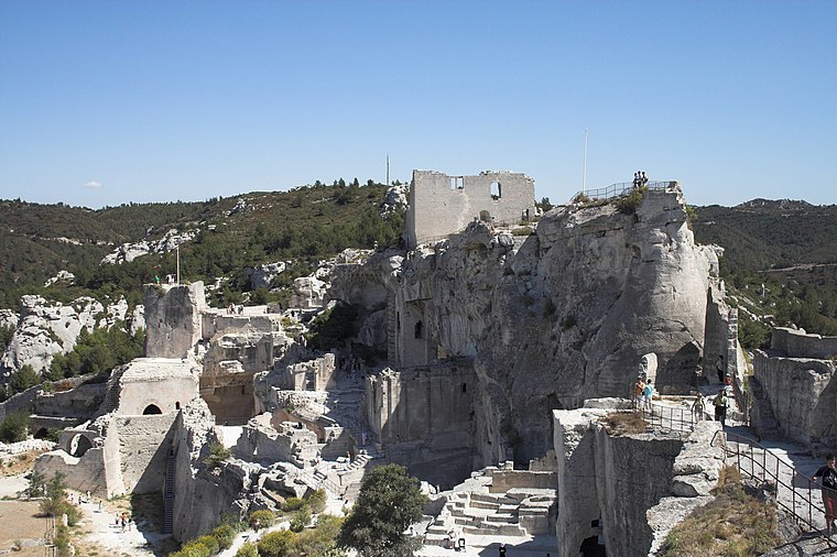
Photo: Ignis, CC BY-SA 3.0.
The Château des Baux is a ruined fortified castle built during the 10th century, located in Les Baux-de-Provence, Bouches-du-Rhône, southern France. Château des Baux is situated 2 km east of Reservoir les Canonnetes.
Musée des Santons
Museum

Photo: Marianne Casamance, CC BY-SA 3.0.
Musée des Santons is a museum, which is situated 2 km east of Reservoir les Canonnetes.
Places in the Area
Nearby places include Les Baux-de-Provence and Maussane-les-Alpilles.
Les Baux-de-Provence

Photo: Benh, CC BY-SA 3.0.
Les Baux de Provence is a beautiful medieval town in Provence, whose hillsides are brushed with lavender.
Maussane-les-Alpilles
Village

Photo: Gortyna, CC BY-SA 3.0.
Maussane-les-Alpilles is a commune in the Bouches-du-Rhône department in the Provence-Alpes-Cote d'Azur region in Southern France. Part of Alpilles Regional Natural Park, it is located between Saint-Rémy-de-Provence to the north and Saint-Martin-de-Crau to the south. Maussane-les-Alpilles is situated 3½ km southeast of Reservoir les Canonnetes.
Tours de Castillon
Locality

Photo: Malost, CC BY-SA 3.0.
Tours de Castillon is a locality, which is situated 4 km south of Reservoir les Canonnetes.
Reservoir les Canonnetes
- Type: Water tower
- Categories: building and industry
- Location: Fontvieille, Arrondissement of Arles, Bouches-du-Rhône, Provence-Alpes-Côte d’Azur, France, Europe
- View on OpenStreetMap
Latitude
43.73784° or 43° 44′ 16″ northLongitude
4.77066° or 4° 46′ 14″ eastOpen location code
8FM6PQQC+47OpenStreetMap ID
way 449595303OpenStreetMap feature
building=yesOpenStreetMap feature
man_made=water_tower
This page is based on OpenStreetMap, Wikidata, and Wikimedia Commons.
We’d love your help improving our open data sources. Thank you for contributing.
Satellite Map
Discover Reservoir les Canonnetes from above in high-definition satellite imagery.
Notable Places Nearby
Highlights include Mont Paon and La citerne.
Nearby Places
Explore places such as SPA - Refuge Saint-Roch and Domaine départemental du Mont Paon.
Bouches-du-Rhône: Must-Visit Destinations
Delve into Marseille, Aix-en-Provence, Arles, and Salon-de-Provence.
Curious Water Towers to Discover
Uncover intriguing water towers from every corner of the globe.
About Mapcarta. Data © OpenStreetMap contributors and available under the Open Database License". Text is available under the CC BY-SA 4.0 license, except for photos, directions, and the map. Photo: Nikater, CC BY-SA 4.0.