Spielplatz BMX-Bahn
Spielplatz BMX-Bahn is a playground in Schwabach, Middle Franconia, Bavaria. Spielplatz BMX-Bahn is situated nearby to the sports venue Tennis Rot-Weiß, as well as near the protected area Wenglein’sche Vogelschutzanlage.| Tap on a place to explore it |
Places of Interest Nearby
Highlights include Schwabach and St. Johannes and St. Martin.
Schwabach
Railway station
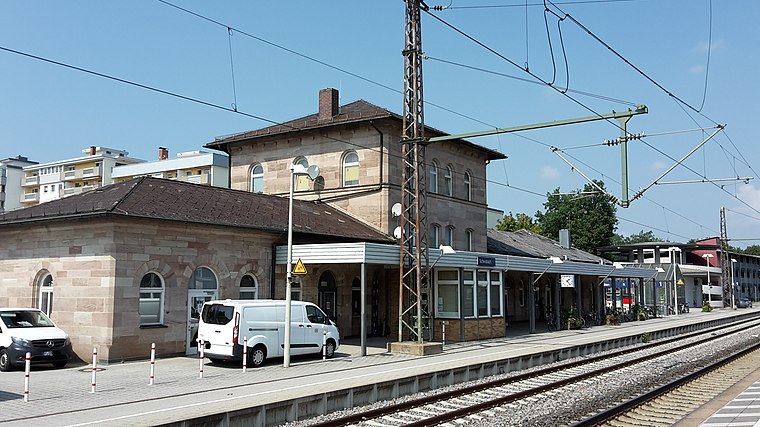
Photo: Dealerofsalvation, CC BY-SA 4.0.
Schwabach station is a railway station in the municipality of Schwabach, located in Middle Franconia, Germany. The station is on the Nuremberg–Augsburg and Nuremberg–Roth lines of Deutsche Bahn. Schwabach is situated 1 km north of Spielplatz BMX-Bahn.
St. Johannes and St. Martin
Church
 St. Johannes and St. Martin is a church, which is situated 1½ km northwest of Spielplatz BMX-Bahn.
Rathaus Schwabach
Town hall

Photo: Tilman2007, CC BY-SA 4.0.
Rathaus Schwabach is a town hall, which is situated 1½ km northwest of Spielplatz BMX-Bahn.
Places in the Area
Nearby places include Igelsdorf and Ottersdorf.


Nasbach
Suburb

Photo: Kasa Fue, CC BY-SA 4.0.
Nasbach is a suburb, which is situated 3 km north of Spielplatz BMX-Bahn.
Spielplatz BMX-Bahn
- Type: Playground
- Category: recreation area
- Location: Schwabach, Middle Franconia, Franconia, Bavaria, Germany, Central Europe, Europe
- View on OpenStreetMap
Latitude
49.31632° or 49° 18′ 59″ northLongitude
11.03433° or 11° 2′ 4″ eastOpen location code
8FXH828M+GPOpenStreetMap ID
way 451599917OpenStreetMap feature
leisure=playground
This page is based on OpenStreetMap, Wikidata, and Wikimedia Commons.
We’d love your help improving our open data sources. Thank you for contributing.
Satellite Map
Discover Spielplatz BMX-Bahn from above in high-definition satellite imagery.
Notable Places Nearby
Highlights include Tennis Rot-Weiß and Wenglein’sche Vogelschutzanlage.
Nearby Places
Explore places such as Goldschlägerstadt Schwabach and Blumen Dollinger.
Middle Franconia: Must-Visit Destinations
Delve into Nuremberg, Erlangen, Fürth, and Ansbach.
Curious Playgrounds to Discover
Uncover intriguing playgrounds from every corner of the globe.
About Mapcarta. Data © OpenStreetMap contributors and available under the Open Database License". Text is available under the CC BY-SA 4.0 license, except for photos, directions, and the map. Photo: Traveler100, CC BY-SA 4.0.