Centre de secours principal Rouen Sud
Centre de secours principal Rouen Sud is a fire station in Rouen, Seine-Maritime, Normandy which is located on Rue du Petit Quevilly. Centre de secours principal Rouen Sud is situated nearby to the government office Caf de Seine-Maritime, as well as near Chambre de métiers et de l’artisanat (CMA) - Seine-Maritime.| Tap on a place to explore it |
- Type: Fire station
- Also known as: “CSP Rouen Sud”
- Address: Rue du Petit Quevilly, Rouen, 76100
Places of Interest Nearby
Highlights include Maritime, Fluvial and Harbour Museum of Rouen and Fontaine Jean-Baptiste.
Maritime, Fluvial and Harbour Museum of Rouen
Museum

Photo: Nortix08, CC BY-SA 4.0.
The Maritime, Fluvial and Harbour Museum of Rouen is a museum dedicated to the history of the port of Rouen, which is one of the greatest ports of France. Maritime, Fluvial and Harbour Museum of Rouen is situated 2 km northwest of Centre de secours principal Rouen Sud.
Fontaine Jean-Baptiste
Fountain

Photo: Jeffou06, CC BY-SA 3.0.
Fontaine Jean-Baptiste is a fountain, which is situated 450 metres south of Centre de secours principal Rouen Sud.
Rouen Cathedral
Church
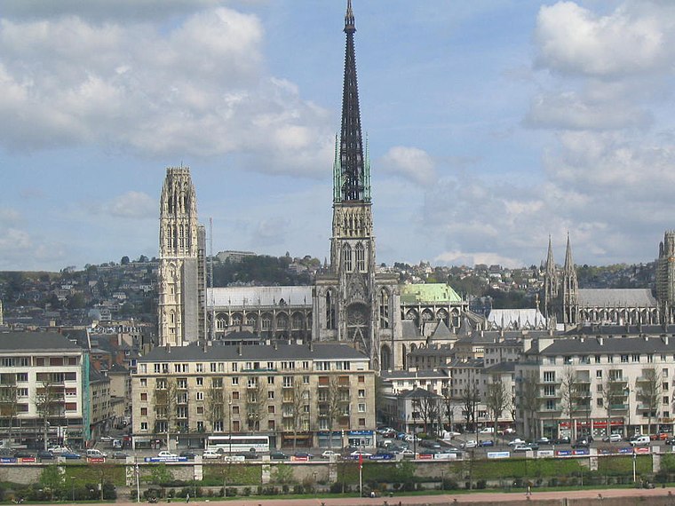
Photo: Wikimedia, CC BY-SA 3.0.
Rouen Cathedral is a Catholic church in Rouen, Normandy, France. It is the see of the Archbishop of Rouen, Primate of Normandy. It is famous for its three towers, each in a different style. Rouen Cathedral is situated 1½ km northeast of Centre de secours principal Rouen Sud.
Places in the Area
Nearby places include Place Saint-Clément and Le Petit-Quevilly.
Place Saint-Clément
Neighborhood
Photo: Jeffou06, CC BY-SA 3.0.
Place Saint-Clément is a neighborhood.
Le Petit-Quevilly
Town

Photo: Giogo, CC BY-SA 3.0.
Le Petit-Quevilly is a commune in the Seine-Maritime department, region of Normandy, France.
Rouen

Photo: stephane martin, CC BY-SA 2.0.
Rouen is the capital of the French region of Normandy on the River Seine, 135 km northwest from the centre of Paris. The city has a population of 110,000 and its metropolitan area includes some 666,000 inhabitants.
Centre de secours principal Rouen Sud
Latitude
49.43116° or 49° 25′ 52″ northLongitude
1.07579° or 1° 4′ 33″ eastOpen location code
8FX3C3JG+F8OpenStreetMap ID
way 452180870OpenStreetMap feature
amenity=fire_station
This page is based on OpenStreetMap, Wikidata, and Wikimedia Commons.
We’d love your help improving our open data sources. Thank you for contributing.
Satellite Map
Discover Centre de secours principal Rouen Sud from above in high-definition satellite imagery.
Notable Places Nearby
Highlights include Caf de Seine-Maritime and Chambre de métiers et de l’artisanat (CMA) - Seine-Maritime.
Nearby Places
Explore places such as Résidence Saint-Sever and France Pare-Brise.
Normandy: Must-Visit Destinations
Delve into Orne, Rouen, Seine-Maritime, and Le Havre.
Curious Fire Stations to Discover
Uncover intriguing fire stations from every corner of the globe.
About Mapcarta. Data © OpenStreetMap contributors and available under the Open Database License". Text is available under the CC BY-SA 4.0 license, except for photos, directions, and the map. Photo: Inkey, CC BY-SA 3.0.