Tennisverein Ensdorf
Tennisverein Ensdorf is a sports venue in Ensdorf, Saarlouis, Saarland. Tennisverein Ensdorf is situated nearby to the water park Freibad Ensdorf, as well as near the pitch Hundesportverein.| Tap on a place to explore it |
Places of Interest Nearby
Highlights include Saar Polygon and Saint Mary’s Church.
Saar Polygon
Scenic viewpoint

Photo: Milseburg, CC BY-SA 4.0.
The Saar Polygon in Ensdorf, Saarland is a monument commemorating the coal mining industry in Saarland, which ended in June 2012. Saar Polygon is situated 1 km north of Tennisverein Ensdorf.
Saint Mary’s Church
Church

Photo: Kolling, CC BY-SA 3.0.
Saint Mary’s Church is situated 730 metres southwest of Tennisverein Ensdorf.
Marienpark Hasenberg
Park

Photo: LoKiLeCh, CC BY-SA 3.0.
Marienpark Hasenberg is situated 1 km south of Tennisverein Ensdorf.
Places in the Area
Nearby places include Schwalbach and Saarlouis.
Schwalbach
Village
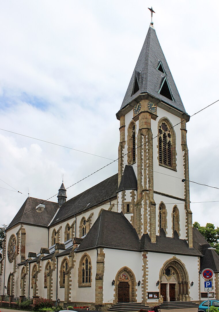
Photo: Mstp77, CC BY-SA 3.0.
Schwalbach is a municipality in the district of Saarlouis, in Saarland, Germany. It is situated approximately 5 km east of Saarlouis, and 15 km northwest of Saarbrücken. Schwalbach is situated 2½ km east of Tennisverein Ensdorf.
Saarlouis
Photo: Kolling, CC BY-SA 3.0.
Saarlouis is a city and district in Saarland. With close to 200,000 inhabitants, it is the second most populous district in Saarland after neighbouring Saarbrücken, though only about 35,000 live in the city of Saarlouis itself.
Bous
Village

Photo: Wikimedia, CC BY-SA 3.0.
Bous is a municipality in the district of Saarlouis, in Saarland, Germany. It is situated on the river Saar, approx. 5 km southeast of Saarlouis, and 15 km west of Saarbrücken. Bous is situated 4 km south of Tennisverein Ensdorf.
Tennisverein Ensdorf
- Type: Sports venue
- Categories: tennis, recreation area, and sports location
- Location: Ensdorf, Saarlouis, Saarland, Germany, Central Europe, Europe
- View on OpenStreetMap
Latitude
49.31023° or 49° 18′ 37″ northLongitude
6.78761° or 6° 47′ 15″ eastOpen location code
8FX88Q6Q+32OpenStreetMap ID
way 45395791OpenStreetMap feature
leisure=sports_centreOpenStreetMap feature
sport=tennis
This page is based on OpenStreetMap, Wikidata, and Wikimedia Commons.
We’d love your help improving our open data sources. Thank you for contributing.
Satellite Map
Discover Tennisverein Ensdorf from above in high-definition satellite imagery.
Notable Places Nearby
Highlights include Freibad Ensdorf and Hundesportverein.
Nearby Places
Explore places such as Das Esszimmer am Wald and Ensdorfer Stollen.
Saarland: Must-Visit Destinations
Delve into Saarbrücken, Saarlouis, Homburg, and Merzig.
Curious Sports Venues to Discover
Uncover intriguing sports venues from every corner of the globe.
About Mapcarta. Data © OpenStreetMap contributors and available under the Open Database License". Text is available under the CC BY-SA 4.0 license, except for photos, directions, and the map. Photo: Lokilech, CC BY-SA 3.0.