Benediktinerinnenkloster
Benediktinerinnenkloster is a ruins in Buxtehude, Stade, Lower Saxony. Benediktinerinnenkloster is situated nearby to the school Grundschule Altkloster, as well as near the fire station Feuerwehr Buxtehude Zug 2.| Tap on a place to explore it |
Places of Interest Nearby
Highlights include Buxtehude station and St.-Petri-Kirche.
Buxtehude station
Railway station

Photo: Gerhard kemme, CC0.
Buxtehude is a railway station in northwestern Germany. The station is located in the town of Buxtehude. It is located on two railway lines: the Lower Elbe Railway, which runs between Cuxhaven and Hamburg, and the Bremerhaven–Buxtehude line of the Eisenbahnen und Verkehrsbetriebe Elbe-Weser to Bremervörde. Buxtehude station is situated 530 metres north of Benediktinerinnenkloster.
St.-Petri-Kirche
Church
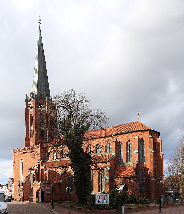
Photo: Knipptang, CC BY-SA 3.0.
St.-Petri-Kirche is a church, which is situated 1½ km northeast of Benediktinerinnenkloster.
Halepaghen Grammar School
School

Photo: Boereck, Public domain.
The Halepaghen Grammar School, or HPS, is a gymnasium in Buxtehude. The school was mentioned for the first time in 1390 as an grammar school. The school was named after Gerhard Halepaghe, a famous graduate from Buxtehude. Halepaghen Grammar School is situated 1¼ km north of Benediktinerinnenkloster.
Places in the Area
Nearby places include Dammhausen and Neukloster.
Dammhausen
Suburb

Photo: Tadü, CC BY-SA 4.0.
Dammhausen is a suburb, which is situated 3½ km northwest of Benediktinerinnenkloster.
Neukloster
Suburb

Photo: Dkvtig, CC BY-SA 4.0.
Neukloster is a suburb, which is situated 4 km northwest of Benediktinerinnenkloster.
Ovelgönne
Suburb

Photo: Aeroid, CC BY-SA 3.0.
Ovelgönne is a suburb, which is situated 4½ km southeast of Benediktinerinnenkloster.
Benediktinerinnenkloster
- Type: Ruins
- Category: historic site
- Location: Buxtehude, Stade, Elbe-Weser Triangle, Lower Saxony, Germany, Central Europe, Europe
- View on OpenStreetMap
Latitude
53.46604° or 53° 27′ 58″ northLongitude
9.69102° or 9° 41′ 28″ eastOpen location code
9F5FFM8R+CCOpenStreetMap ID
way 454644406OpenStreetMap feature
historic=ruins
This page is based on OpenStreetMap, Wikidata, and Wikimedia Commons.
We’d love your help improving our open data sources. Thank you for contributing.
Satellite Map
Discover Benediktinerinnenkloster from above in high-definition satellite imagery.
Places with the Same Name
Discover other places named “Benediktinerinnenkloster”.
Notable Places Nearby
Highlights include Grundschule Altkloster and Feuerwehr Buxtehude Zug 2.
Nearby Places
Explore places such as Dat EstePflegeHus and Tabakwaren Kähler.
Elbe-Weser Triangle: Must-Visit Destinations
Delve into Bremerhaven, Cuxhaven, Stade, and Neuwerk.
Curious Ruins to Discover
Uncover intriguing ruins from every corner of the globe.
About Mapcarta. Data © OpenStreetMap contributors and available under the Open Database License". Text is available under the CC BY-SA 4.0 license, except for photos, directions, and the map. Photo: hh oldman, CC BY 3.0.