Pingo Doce
Pingo Doce is a supermarket in O. Azeméis, Riba-Ul, Ul, Macinhata da Seixa, Madail, Oliveira de Azeméis Municipality, Aveiro District. Pingo Doce is situated nearby to the sports venue Pavilhão da Escola Livre, as well as near the cemetery Cemitério de Oliveira de Azeméis.| Tap on a place to explore it |
Places of Interest Nearby
Highlights include Estádio Carlos Osório and Oliveira de Azeméis railway station.
Estádio Carlos Osório
Stadium

Photo: HBrunoK, Public domain.
Estádio Carlos Osório is a stadium in Oliveira de Azeméis, Aveiro, Portugal. It is currently used for football matches and is the home ground of Liga de Honra side U.D. Estádio Carlos Osório is situated 710 metres southeast of Pingo Doce.
Oliveira de Azeméis railway station
Railway station

Photo: JP Ribeiro, CC BY-SA 4.0.
Oliveira de Azeméis railway station is situated 710 metres southwest of Pingo Doce.
Câmara Municipal de Oliveira de Azeméis
Town hall
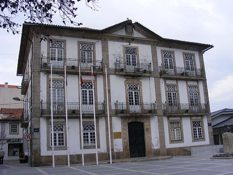
Photo: Piquito, Public domain.
Câmara Municipal de Oliveira de Azeméis is a town hall, which is situated 730 metres south of Pingo Doce.
Places in the Area
Nearby places include Ul (Oliveira de Azeméis) and Vila de Cucujães.
Ul (Oliveira de Azeméis)
Village

Photo: Vitor Oliveira, CC BY-SA 2.0.
Oliveira de Azeméis, Santiago de Riba-Ul, Ul, Macinhata da Seixa e Madail is a civil parish in the municipality of Oliveira de Azeméis in Porto Metropolitan Area, Portugal. Ul (Oliveira de Azeméis) is situated 3 km southwest of Pingo Doce.
Vila de Cucujães
Town

Photo: A14843, CC BY-SA 3.0.
Vila de Cucujães is a town, which is situated 3 km northwest of Pingo Doce.
Freguesia de Travanca
Village

Photo: Wikimedia, CC BY-SA 4.0.
Freguesia de Travanca is a village, which is situated 3½ km south of Pingo Doce.
Pingo Doce
- Type: Supermarket
- Postal code: 3270-261
- Categories: building, shop, and food
- Location: O. Azeméis, Riba-Ul, Ul, Macinhata da Seixa, Madail, Oliveira de Azeméis Municipality, Aveiro District, Portugal, Iberia, Europe
- View on OpenStreetMap
Latitude
40.84571° or 40° 50′ 45″ northLongitude
-8.4772° or 8° 28′ 38″ westBranch
Oliveira de Azemeis - FarrapaBrand
Pingo DoceOpen location code
8CGHRGWF+74OpenStreetMap ID
way 464142179OpenStreetMap feature
building=yesOpenStreetMap feature
shop=supermarket
This page is based on OpenStreetMap, Wikidata, and Wikimedia Commons.
We’d love your help improving our open data sources. Thank you for contributing.
Satellite Map
Discover Pingo Doce from above in high-definition satellite imagery.
Places with the Same Name
Discover other places named “Pingo Doce”.
Notable Places Nearby
Highlights include Pavilhão da Escola Livre and Cemitério de Oliveira de Azeméis.
Nearby Places
Explore places such as TUAZ Linha Laranja - Rua Joé Morais Dias and Simoldes Milling Center.
Portugal: Must-Visit Destinations
Delve into Lisbon, Caldas da Rainha, Porto, and Coimbra.
Curious Supermarkets to Discover
Uncover intriguing supermarkets from every corner of the globe.
About Mapcarta. Data © OpenStreetMap contributors and available under the Open Database License". Text is available under the CC BY-SA 4.0 license, except for photos, directions, and the map. Photo: Tsy1980, CC BY-SA 4.0.