Kläranlage Kogl
Kläranlage Kogl is a wastewater treatment plant in Pilgersdorf, Oberpullendorf District, Burgenland. Kläranlage Kogl is situated nearby to the village Kogl im Burgenland, as well as near Saint Oswald of Northumbria Church.| Tap on a place to explore it |
Places of Interest Nearby
Highlights include Saint Oswald of Northumbria Church and Sebastianssäule Lebenbrunn.
Saint Oswald of Northumbria Church
Church

Photo: Ufoao, CC BY-SA 3.0 at.
Saint Oswald of Northumbria Church is situated 410 metres southwest of Kläranlage Kogl.
Sebastianssäule Lebenbrunn
Memorial

Photo: Robert Heilinger, CC BY-SA 3.0.
Sebastianssäule Lebenbrunn is a memorial, which is situated 1½ km north of Kläranlage Kogl.
Filialkirche hl. Antonius
Church

Photo: Robert Heilinger, CC BY-SA 3.0.
Filialkirche hl. Antonius is a church, which is situated 3 km north of Kläranlage Kogl.
Places in the Area
Nearby places include Kogl im Burgenland and Redlschlag.


Salmannsdorf
Village
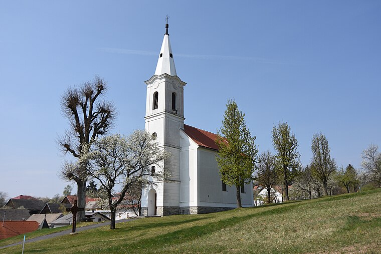
Photo: Nxr-at, CC BY-SA 4.0.
Salmannsdorf is a village, which is situated 4½ km south of Kläranlage Kogl.
Kläranlage Kogl
- Type: Wastewater treatment plant
- Category: industry
- Location: Pilgersdorf, Oberpullendorf District, Burgenland, Austria, Central Europe, Europe
- View on OpenStreetMap
Latitude
47.44743° or 47° 26′ 51″ northLongitude
16.30301° or 16° 18′ 11″ eastOpen location code
8FVRC8W3+X6OpenStreetMap ID
way 469026057OpenStreetMap feature
man_made=wastewater_plant
This page is based on OpenStreetMap, Wikidata, and Wikimedia Commons.
We’d love your help improving our open data sources. Thank you for contributing.
Satellite Map
Discover Kläranlage Kogl from above in high-definition satellite imagery.
Notable Places Nearby
Highlights include FF Kogl and Koglberg.
Nearby Places
Explore places such as Leichenhalle Kogl and wir.ZT GmbH.
Burgenland: Must-Visit Destinations
Delve into Eisenstadt, Neusiedl am See, Rust, and Güssing.
Curious Wastewater Treatment Plants to Discover
Uncover intriguing wastewater treatment plants from every corner of the globe.
About Mapcarta. Data © OpenStreetMap contributors and available under the Open Database License". Text is available under the CC BY-SA 4.0 license, except for photos, directions, and the map. Photo: Wikimedia, CC BY-SA 4.0.