Fredlygård
Fredlygård is a farm in Gribskov Kommune, Capital Region. Fredlygård is situated nearby to the village Græsted, as well as near Søborg.| Tap on a place to explore it |
Places of Interest Nearby
Highlights include Græsted railway station and Søborg Castle.
Græsted railway station
Railway station

Photo: Wikimedia, CC BY-SA 3.0.
Græsted station is a railway station serving the town of Græsted in North Zealand, Denmark. Græsted station is located on the Gribskov Line from Hillerød to Gilleleje. Græsted railway station is situated 2 km southeast of Fredlygård.
Søborg Castle

Photo: Knud Winckelmann, CC BY-SA 3.0.
Søborg Castle is a ruined castle south of Gilleleje in North Zealand, Denmark. It was one of the strongest castles in Denmark and was also used as a prison. Søborg Castle is situated 3 km east of Fredlygård.
Græsted Church
Church

Photo: Thomas Vedelsbøl, CC0.
Græsted Church is situated 2½ km south of Fredlygård.
Places in the Area
Nearby places include Græsted and Søborg.
Græsted
Village
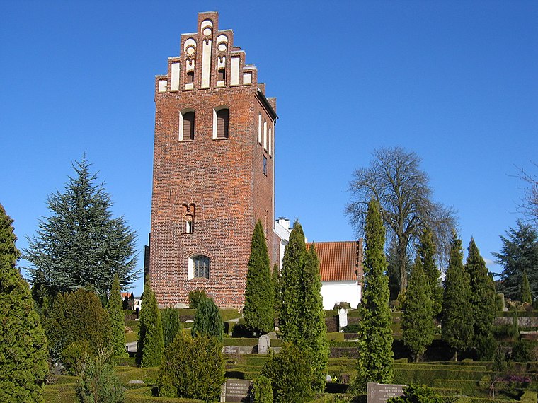
Photo: Thomas81, CC BY 2.5 dk.
Græsted is one of the main towns of the Gribskov municipality in the Danish Region Hovedstaden. The town is in northern Sjælland, just south of Gilleleje, and has a population of 3,662. The whole of Græsted Parish had 4769 inhabitants. Græsted is situated 3 km southeast of Fredlygård.
Søborg
Village
Søborg is a parish and small community situated a few kilometers south of Gilleleje in Gribskov Municipality, North Zealand, Denmark, some 40 km north of Copenhagen. Søborg is situated 3½ km east of Fredlygård.
Blistrup
Village
Blistrup is a town in the Gribskov Municipality in North Zealand, Denmark. As of 2025, it has a population of 1,156. Blistrup is situated 3½ km west of Fredlygård.
Fredlygård
- Type: Farm
- Category: agriculture
- Location: Gribskov Kommune, Capital Region, Denmark, Nordic countries, Europe
- View on OpenStreetMap
Latitude
56.08683° or 56° 5′ 13″ northLongitude
12.26553° or 12° 15′ 56″ eastOpen location code
9F8J37P8+P6OpenStreetMap ID
way 476910009OpenStreetMap feature
landuse=farmyard
This page is based on OpenStreetMap, Wikidata, and Wikimedia Commons.
We’d love your help improving our open data sources. Thank you for contributing.
Satellite Map
Discover Fredlygård from above in high-definition satellite imagery.
Notable Places Nearby
Highlights include Gribskovbanen and Gilleleje Wine.
Nearby Places
Explore places such as Egemose and Byagergård.
Denmark: Must-Visit Destinations
Delve into Copenhagen, Aarhus, Odense, and Aalborg.
Curious Farms to Discover
Uncover intriguing farms from every corner of the globe.
About Mapcarta. Data © OpenStreetMap contributors and available under the Open Database License". Text is available under the CC BY-SA 4.0 license, except for photos, directions, and the map. Photo: Wikimedia, CC BY-SA 3.0.