Porto.Fala
Porto.Fala is a language school in Bonfim, Porto which is located on Rua do Barão de São Cosme. Porto.Fala is situated nearby to the church Igreja Lusitana do Cristo Redentor, as well as near the art gallery Galeria de Arquitectura.| Tap on a place to explore it |
- Email: geral@portuguesecoursesporto.com
- Type: Language school
- Address: Rua do Barão de São Cosme 266, Porto, 4300-096
Places of Interest Nearby
Highlights include Junta de Freguesia do Bonfim and Municipal Library of Porto.
Junta de Freguesia do Bonfim
Town hall
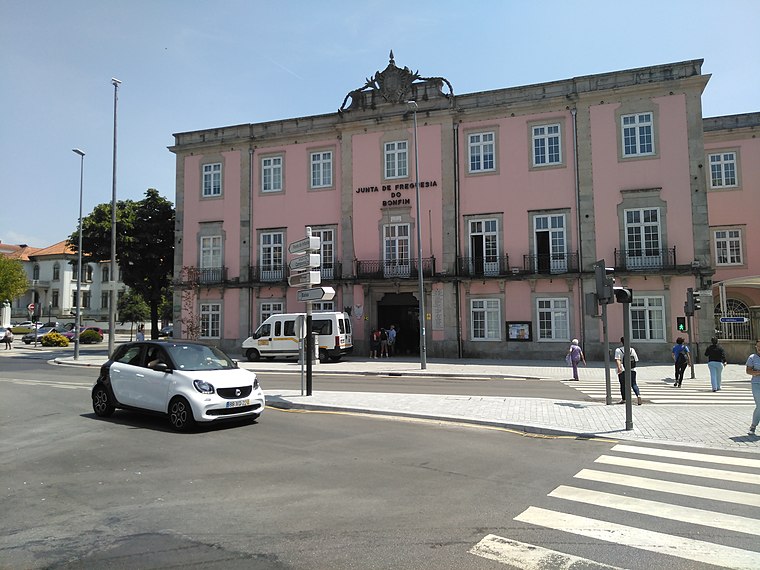
Photo: Threeohsix, CC BY-SA 4.0.
Junta de Freguesia do Bonfim is a town hall, which is situated 150 metres northeast of Porto.Fala.
Municipal Library of Porto
Library

Photo: JotaCartas, CC BY-SA 3.0.
The Municipal Library of Porto is a library located in the civil parish of Bonfim, municipality of Porto in the Portuguese district of the same name. Municipal Library of Porto is situated 180 metres southwest of Porto.Fala.
Campo 24 de Agosto station
Railway station

Photo: Ymblanter, CC BY-SA 4.0.
Campo 24 de Agosto is a light rail station on the Porto Metro system in Porto, Portugal. The station is underground, adjacent to the Campo 24 de Agosto square, from which it takes its name. Campo 24 de Agosto station is situated 210 metres north of Porto.Fala.
Places in the Area
Nearby places include Fontainhas and Santo Ildefonso.

Santo Ildefonso
Neighborhood

Photo: Wikimedia, CC BY-SA 3.0.
Santo Ildefonso is a former civil parish in the municipality of Porto, Portugal. In 2013, the parish merged into the new parish Cedofeita, Santo Ildefonso, Sé, Miragaia, São Nicolau e Vitória. The population in 2011 was 9,029, in an area of 1.24 km2.
Encosta dos Guindais
Neighborhood

Photo: Wikimedia, CC BY-SA 3.0.
Encosta dos Guindais is a neighborhood.
Porto.Fala
- Categories: building, school building, and education
- Location: Bonfim, Porto, Porto District, Portugal, Iberia, Europe
- View on OpenStreetMap
Latitude
41.14702° or 41° 8′ 49″ northLongitude
-8.59955° or 8° 35′ 58″ westOpen location code
8CHH4CW2+R5OpenStreetMap ID
way 483120300OpenStreetMap feature
amenity=language_schoolOpenStreetMap feature
building=school
This page is based on OpenStreetMap, Wikidata, and Wikimedia Commons.
We’d love your help improving our open data sources. Thank you for contributing.
Satellite Map
Discover Porto.Fala from above in high-definition satellite imagery.
Notable Places Nearby
Highlights include Igreja Lusitana do Cristo Redentor and Galeria de Arquitectura.
Nearby Places
Explore places such as Café Restaurante Astronauta and Asa da Mosca.
Portugal: Must-Visit Destinations
Delve into Lisbon, Caldas da Rainha, Coimbra, and Braga.
Curious Language Schools to Discover
Uncover intriguing language schools from every corner of the globe.
About Mapcarta. Data © OpenStreetMap contributors and available under the Open Database License". Text is available under the CC BY-SA 4.0 license, except for photos, directions, and the map. Photo: Olegivvit, CC BY 2.5.