Taisto
Taisto is a building in Orivesi, Tampere, Pirkanmaa which is located on Asematie. Taisto is situated nearby to the railway station Oriveden rautatieasema, as well as near Orivesi railway station.| Tap on a place to explore it |
- Type: Commercial building
- Also known as: “Taiston talo”
- Address: Asematie 9, Orivesi, 35100
Places of Interest Nearby
Highlights include Orivesi railway station and Orivesi Church.
Orivesi railway station
Railway station
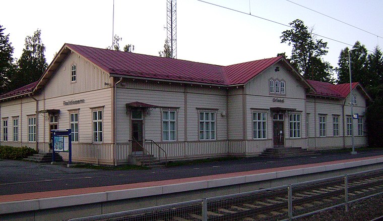
Photo: Junafani, CC BY-SA 3.0.
The Orivesi railway station is located in the town of Orivesi, Finland. The class IV station was built during the years 1881 to 1883. The station has been renewed several times, but the station building has remained almost unchanged in appearance. Orivesi railway station is situated 330 metres northeast of Taisto.
Orivesi Church
Church

Photo: Teme007, CC BY-SA 3.0.
Orivesi Church is situated 3 km north of Taisto.
Orivesi center railway stop
Railway stop

Photo: Junafani, CC BY-SA 3.0.
Orivesi center railway stop is situated 3 km north of Taisto.
Taisto
- Categories: building and office
- Location: Orivesi, Tampere, Pirkanmaa, Finnish Lakeland, Finland, Nordic countries, Europe
- View on OpenStreetMap
Latitude
61.64827° or 61° 38′ 54″ northLongitude
24.36311° or 24° 21′ 47″ eastOpen location code
9GH6J9X7+86OpenStreetMap ID
way 485327719OpenStreetMap feature
building=commercial
This page is based on OpenStreetMap, Wikidata, and Wikimedia Commons.
We’d love your help improving our open data sources. Thank you for contributing.
Satellite Map
Discover Taisto from above in high-definition satellite imagery.
Notable Places Nearby
Highlights include Oriveden rautatieasema and Pappilan kenttä.
Nearby Places
Explore places such as Tapahtumakahvila Lilja and Joonas-koulu.
Pirkanmaa: Must-Visit Destinations
Delve into Tampere, Nokia, Valkeakoski, and Akaa.
Curious Places to Discover
Uncover intriguing places from every corner of the globe.
About Mapcarta. Data © OpenStreetMap contributors and available under the Open Database License". Text is available under the CC BY-SA 4.0 license, except for photos, directions, and the map. Photo: Wikimedia, Public domain.