Josef-Breher-Mittelschule
Josef-Breher-Mittelschule is a school in Pullach i.Isartal, Munich, Bavaria which is located on Kagerbauerstraße. Josef-Breher-Mittelschule is situated nearby to the fire station Freiwillige Feuerwehr Pullach, as well as near the town hall Rathaus der Gemeinde Pullach i. Isartal.| Tap on a place to explore it |
- Email: schulleitung@mittelschule.pullach.de
- Type: School
- Address: Kagerbauerstraße 7, Pullach i. Isartal
- Wheelchair access: yes
Places of Interest Nearby
Highlights include Heilig-Geist-Brunnen and Wasserkraftwerk Pullach.
Heilig-Geist-Brunnen
Fountain

Photo: Rudolph Buch, CC0.
Heilig-Geist-Brunnen is a fountain, which is situated 280 metres northeast of Josef-Breher-Mittelschule.
Wasserkraftwerk Pullach
Power station
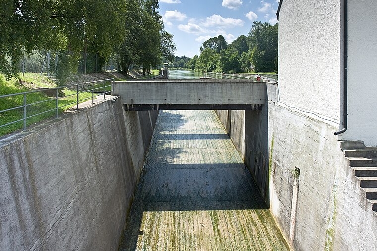
Photo: Richard Bartz, CC BY-SA 2.5.
Wasserkraftwerk Pullach is a power station, which is situated 320 metres east of Josef-Breher-Mittelschule.
Alte Heilig-Geist-Kirche
Church

Photo: Rufus46, CC BY-SA 3.0.
Alte Heilig-Geist-Kirche is a church, which is situated 370 metres northeast of Josef-Breher-Mittelschule.
Places in the Area
Nearby places include Pullach and Grünwald.
Pullach
Village

Photo: Wikimedia, CC BY-SA 3.0.
Pullach, officially Pullach i. Isartal, is a municipality in the district of Munich in Bavaria in Germany. It lies on the Isar Valley Railway and is served by the S 7 line of the Munich S-Bahn, at the Großhesselohe Isartalbahnhof, Pullach and Höllriegelskreuth railway stations.
Grünwald
Town
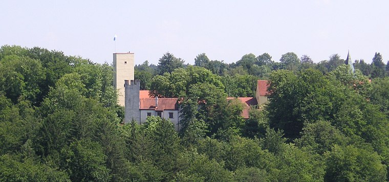
Photo: Wikimedia, CC BY-SA 3.0.
Grünwald is a municipality in the district of Munich, in the state of Bavaria, Germany. It is located on the right bank of the Isar, 12 km southwest of Munich.

Josef-Breher-Mittelschule
- Category: education
- Location: Pullach i.Isartal, Munich, Upper Bavaria, Bavaria, Germany, Central Europe, Europe
- View on OpenStreetMap
Latitude
48.05399° or 48° 3′ 14″ northLongitude
11.51935° or 11° 31′ 10″ eastOpen location code
8FWH3G39+HPOpenStreetMap ID
way 491424103OpenStreetMap feature
amenity=schoolOpenStreetMap attribute
wheelchair=yes
This page is based on OpenStreetMap, Wikidata, and Wikimedia Commons.
We’d love your help improving our open data sources. Thank you for contributing.
Satellite Map
Discover Josef-Breher-Mittelschule from above in high-definition satellite imagery.
Notable Places Nearby
Highlights include Freiwillige Feuerwehr Pullach and Freiwillige Feuerwehr Pullach im Isartal.
Nearby Places
Explore places such as VHS Pullach and Pullach, Gartenstraße/Rathaus.
Upper Bavaria: Must-Visit Destinations
Delve into Munich, Ingolstadt, Rosenheim, and Dachau.
Curious Places to Discover
Uncover intriguing places from every corner of the globe.
About Mapcarta. Data © OpenStreetMap contributors and available under the Open Database License". Text is available under the CC BY-SA 4.0 license, except for photos, directions, and the map. Photo: Aconcagua, CC BY-SA 3.0.