PortRVA Phase II
PortRVA Phase II is in Richmond, Virginia. PortRVA Phase II is situated nearby to the government office PlanRVA, as well as near the marketplace Hatch Local.| Tap on a place to explore it |
Places of Interest Nearby
Highlights include Virginia Holocaust Museum and Virginia State Capitol.
Virginia Holocaust Museum
Museum

Photo: Wikimedia, Public domain.
The Virginia Holocaust Museum is a public history museum located in Richmond, Virginia, United States. The museum is dedicated to depicting the Holocaust through the personal stories of its victims. Virginia Holocaust Museum is situated 1 mile northeast of PortRVA Phase II.
Virginia State Capitol
Government office

Photo: Ron Cogswell, CC BY 2.0.
The Virginia State Capitol is the seat of state government of the Commonwealth of Virginia, located in Richmond, the state capital. It houses the oldest elected legislative body in North America, the Virginia General Assembly, first established as the House of Burgesses in 1619. Virginia State Capitol is situated 1 mile north of PortRVA Phase II.
Edgar Allan Poe Museum
Museum
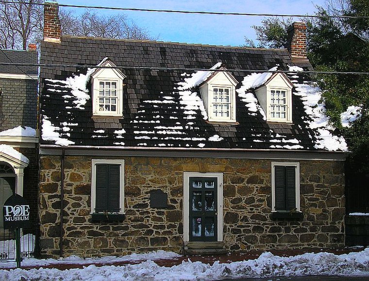
Photo: Albrecht Conz, CC BY-SA 3.0.
The Poe Museum or the Edgar Allan Poe Museum, is a museum located in the Shockoe Bottom neighborhood of Richmond, Virginia, United States, dedicated to American writer Edgar Allan Poe. Edgar Allan Poe Museum is situated 1 mile northeast of PortRVA Phase II.
Places in the Area
Nearby places include Manchester and Shockoe Slip.
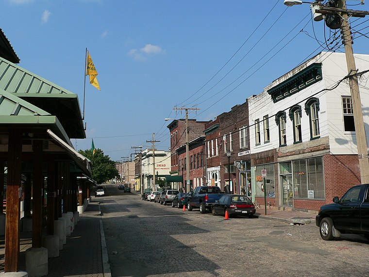
Manchester
Quarter

Photo: Morgan Riley, CC BY 3.0.
Manchester is a former independent city in Virginia in the United States. Prior to receiving independent status, it served as the county seat of Chesterfield County, between 1870 and 1876.
Shockoe Slip
Neighborhood

Photo: Morgan Riley, CC BY 3.0.
Shockoe Slip is a district in the downtown area of Richmond, Virginia. The name "slip" referred to a narrow passageway leading from Main Street to where goods were loaded and unloaded from the former James River and Kanawha Canal.
Shockoe Bottom
Neighborhood
 Shockoe Bottom, historically known as Shockoe Valley, is an area in Richmond, Virginia, just east of downtown, along the James River. Located between Shockoe Hill and Church Hill, Shockoe Bottom contains much of the land included in Colonel William Mayo's 1737 plan of Richmond, making it one of the city's oldest neighborhoods.
PortRVA Phase II
- Type: Construction
- Location: Richmond, Virginia, South, United States, North America
- View on OpenStreetMap
Latitude
37.52383° or 37° 31′ 26″ northLongitude
-77.43881° or 77° 26′ 20″ westOpen location code
8794GHF6+GFOpenStreetMap ID
way 495303209OpenStreetMap feature
landuse=construction
This page is based on OpenStreetMap, Wikidata, and Wikimedia Commons.
We’d love your help improving our open data sources. Thank you for contributing.
Satellite Map
Discover PortRVA Phase II from above in high-definition satellite imagery.
Notable Places Nearby
Highlights include PlanRVA and Hatch Local.
Nearby Places
Explore places such as PortRVA Apartments and Stock Cafe and Bar.
Virginia: Must-Visit Destinations
Delve into Richmond, Arlington, Virginia Beach, and Norfolk.
Curious Places to Discover
Uncover intriguing places from every corner of the globe.
About Mapcarta. Data © OpenStreetMap contributors and available under the Open Database License". Text is available under the CC BY-SA 4.0 license, except for photos, directions, and the map. Photo: Wikimedia, CC0.