OŠ Livada Velenje
OŠ Livada Velenje is a school in Velenje, Slovenia which is located on Efenkova cesta. OŠ Livada Velenje is situated nearby to the pitch Livada - šolsko igrišče, as well as near the square Kardeljev trg.| Tap on a place to explore it |
Places of Interest Nearby
Highlights include Šalek Castle and St. Martin’s Parish Church.
Šalek Castle
Ruins
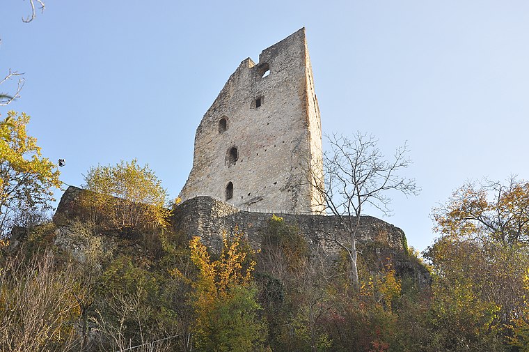
Photo: Wikimedia, CC BY-SA 4.0.
Šalek Castle is a ruins, which is situated 360 metres east of OŠ Livada Velenje.
St. Martin’s Parish Church
Church

Photo: Janezdrilc, CC0.
St. Martin’s Parish Church is situated 500 metres northwest of OŠ Livada Velenje.
Red Hall
Sports venue
Red Hall is a sports facility arena in Velenje, Slovenia. It is the home arena of handball club Gorenje Velenje. The venue can accommodate 2,500 spectators. Red Hall is situated 1 km southwest of OŠ Livada Velenje.
Places in the Area
Nearby places include Velenje and Bevče.
Velenje
Town

Photo: Blazev, Public domain.
Velenje is the sixth-largest city of Slovenia, and the seat of the Municipality of Velenje. The city is located in the traditional Slovenian region of Styria, among the rolling green hills of the Šalek Valley, with the Kamnik–Savinja Alps to the west and the Pohorje Mountains to the east.
Bevče
Village
Bevče is a settlement in the Municipality of Velenje in northern Slovenia. The area is part of the traditional region of Styria. The entire municipality is now included in the Savinja Statistical Region.
Paka pri Velenju
Village
Paka pri Velenju is a settlement in the Municipality of Velenje in northern Slovenia. The area is part of the traditional region of Styria. The entire municipality is now included in the Savinja Statistical Region.
OŠ Livada Velenje
- Type: School
- Address: Efenkova cesta 60, Velenje, 3320
- Categories: building and education
- Location: Velenje, Slovenia, Central Europe, Europe
- View on OpenStreetMap
Latitude
46.36248° or 46° 21′ 45″ northLongitude
15.12268° or 15° 7′ 22″ eastOpen location code
8FRQ946F+X3OpenStreetMap ID
way 495854525OpenStreetMap feature
amenity=schoolOpenStreetMap feature
building=yes
This page is based on OpenStreetMap, Wikidata, and Wikimedia Commons.
We’d love your help improving our open data sources. Thank you for contributing.
Satellite Map
Discover OŠ Livada Velenje from above in high-definition satellite imagery.
Notable Places Nearby
Highlights include Livada - šolsko igrišče and Kardeljev trg.
Nearby Places
Explore places such as OŠ Livada and Mladinski hotel.
Slovenia: Must-Visit Destinations
Delve into Ljubljana, Maribor, Koper, and Celje.
Curious Schools to Discover
Uncover intriguing schools from every corner of the globe.
About Mapcarta. Data © OpenStreetMap contributors and available under the Open Database License". Text is available under the CC BY-SA 4.0 license, except for photos, directions, and the map. Photo: Jjtkk, CC BY 3.0.