Oklahoma City Housing Authority
Oklahoma City Housing Authority is a residential area in Oklahoma, Great Plains. Oklahoma City Housing Authority is situated nearby to Southern Temple Baptist Church, as well as near Top O‘ Town Park.| Tap on a place to explore it |
Places of Interest Nearby
Highlights include Paycom Center and Oklahoma City.
Paycom Center
Stadium
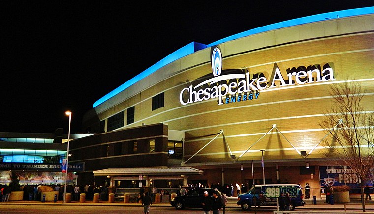
Photo: Urbanative, CC BY-SA 3.0.
Paycom Center is an arena located in downtown Oklahoma City, Oklahoma, United States. It opened in 2002 and since 2008 has served as the home venue for the National Basketball Association 's Oklahoma City Thunder. Paycom Center is situated 1½ miles northwest of Oklahoma City Housing Authority.
Oklahoma City
Railway station

Photo: Nicolas Henderson, CC BY 2.0.
Santa Fe Depot, also known as the Santa Fe Transit Hub, is an Amtrak station located in downtown Oklahoma City, Oklahoma. It is the northern terminus of the Heartland Flyer, a daily train to Fort Worth, Texas. Oklahoma City is situated 1½ miles northwest of Oklahoma City Housing Authority.
Harkins Bricktown Cinemas
Movie theater

Photo: Michael Barera, CC BY-SA 4.0.
Harkins Bricktown Cinemas is a movie theater, which is situated 1¼ miles northwest of Oklahoma City Housing Authority.
Places in the Area
Nearby places include Bricktown and Oklahoma City.
Bricktown
Neighborhood

Photo: texasbackroads, CC BY 2.0.
Downtown in Oklahoma City, Oklahoma is the central business district and has several areas, including the Plaza district, Midtown, Automobile Alley, Metro Park, Film Row, Riverside and Bricktown.
Oklahoma City
 Oklahoma City is the capital and principal city of the state of Oklahoma in the central Frontier Country region of the state. The sprawling city and its suburbs offer multiple sports venues, museums, regional food, and a mix of Native American and cowboy culture.
Downtown Oklahoma City

Photo: Urbanative, CC BY-SA 3.0.
Downtown in Oklahoma City, Oklahoma is the central business district and has several areas, including the Plaza district, Midtown, Automobile Alley, Metro Park, Film Row, Riverside and Bricktown.
Oklahoma City Housing Authority
- Type: Residential area
- Location: Oklahoma, Great Plains, United States, North America
- View on OpenStreetMap
Latitude
35.44882° or 35° 26′ 56″ northLongitude
-97.49338° or 97° 29′ 36″ westOpen location code
8674CGX4+GJOpenStreetMap ID
way 496415662OpenStreetMap feature
landuse=residential
This page is based on OpenStreetMap, Wikidata, and Wikimedia Commons.
We’d love your help improving our open data sources. Thank you for contributing.
Satellite Map
Discover Oklahoma City Housing Authority from above in high-definition satellite imagery.
Places with the Same Name
Discover other places named “Oklahoma City Housing Authority”.
Notable Places Nearby
Highlights include Southern Temple Baptist Church and Top O‘ Town Park.
Nearby Places
Explore places such as West Oak Park School and Ambassador Courts.
Oklahoma: Must-Visit Destinations
Delve into Oklahoma City, Tulsa, Norman, and Lawton.
Curious Residential Areas to Discover
Uncover intriguing residential areas from every corner of the globe.
About Mapcarta. Data © OpenStreetMap contributors and available under the Open Database License". Text is available under the CC BY-SA 4.0 license, except for photos, directions, and the map. Photo: Wikimedia, CC0.