Camping La Roquette
Camping La Roquette is a campsite in Châteaurenard, Arrondissement of Arles, Provence-Alpes-Côte d’Azur which is located on Avenue Jean Mermoz. Camping La Roquette is situated nearby to the sports venue Stade des Baumes, as well as near the community center La Noria.| Tap on a place to explore it |
Places of Interest Nearby
Highlights include Château de Châteaurenard and Town hall of Châteaurenard.
Château de Châteaurenard
Castle

Photo: MattMoissa, CC BY-SA 3.0.
The Château de Châteaurenard is a ruined castle in the commune of Château-Renard in the Loiret département of France. Château de Châteaurenard is situated 1 km west of Camping La Roquette.
Town hall of Châteaurenard
Town hall

Photo: Véronique PAGNIER, CC BY-SA 3.0.
Town hall of Châteaurenard is situated 1¼ km west of Camping La Roquette.
Église Saint Denys
Church

Photo: ADSUBIA, CC BY-SA 3.0.
Église Saint Denys is a church, which is situated 1 km west of Camping La Roquette.
Places in the Area
Nearby places include Châteaurenard and Rognonas.
Châteaurenard
Town

Photo: Wikimedia, CC BY-SA 3.0.
Châteaurenard is a commune in the Arles arrondissement, in the Bouches-du-Rhône department, in the Provence-Alpes-Côte d'Azur region, in southern France.
Rognonas
Village
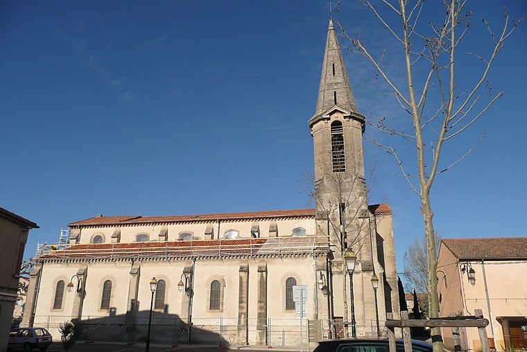
Photo: Wikimedia, CC BY-SA 3.0.
Rognonas is a commune in the Bouches-du-Rhône department in southern France. Rognonas is situated 5 km west of Camping La Roquette.
Caumont-sur-Durance
Village

Photo: Omondi, CC BY-SA 3.0.
Caumont-sur-Durance is a commune in the Vaucluse department in the Provence-Alpes-Côte d'Azur region of Southeastern France. Caumont-sur-Durance is situated 6 km east of Camping La Roquette.
Camping La Roquette
- Type: Campsite
- Address: 745 Avenue Jean Mermoz, Châteaurenard, 13160
- Categories: tourism and camping
- Location: Châteaurenard, Arrondissement of Arles, Bouches-du-Rhône, Provence-Alpes-Côte d’Azur, France, Europe
- View on OpenStreetMap
Latitude
43.88403° or 43° 53′ 3″ northLongitude
4.86936° or 4° 52′ 10″ eastOpen location code
8FM6VVM9+JPOpenStreetMap ID
way 496744144OpenStreetMap feature
landuse=tourismOpenStreetMap feature
tourism=camp_site
This page is based on OpenStreetMap, Wikidata, and Wikimedia Commons.
We’d love your help improving our open data sources. Thank you for contributing.
Satellite Map
Discover Camping La Roquette from above in high-definition satellite imagery.
Notable Places Nearby
Highlights include Stade des Baumes and La Noria.
Nearby Places
Explore places such as Camping and La Box.
Bouches-du-Rhône: Must-Visit Destinations
Delve into Marseille, Aix-en-Provence, Arles, and Salon-de-Provence.
Curious Campsites to Discover
Uncover intriguing campsites from every corner of the globe.
About Mapcarta. Data © OpenStreetMap contributors and available under the Open Database License". Text is available under the CC BY-SA 4.0 license, except for photos, directions, and the map. Photo: Benh, CC BY-SA 3.0.