Capela de Nossa Senhora da Estrela de Manteigas
Capela de Nossa Senhora da Estrela de Manteigas is a church in Manteigas (Santa Maria), Manteigas Municipality, Guarda District. Capela de Nossa Senhora da Estrela de Manteigas is situated nearby to the fell Penhas Douradas, as well as near the scenic viewpoint Miradouro do Fragão do Corvo.| Tap on a place to explore it |
Places of Interest Nearby
Highlights include Mondeguinho - Nascente do Mondego and Câmara Municipal de Manteigas.
Mondeguinho - Nascente do Mondego
Spring
 Mondeguinho - Nascente do Mondego is a spring, which is situated 2 km northwest of Capela de Nossa Senhora da Estrela de Manteigas.
Câmara Municipal de Manteigas
Town hall
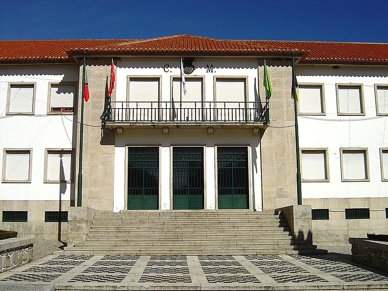
Photo: Vitor Oliveira, CC BY-SA 2.0.
Câmara Municipal de Manteigas is a town hall, which is situated 2½ km east of Capela de Nossa Senhora da Estrela de Manteigas.
Igreja Paroquial de São Pedro de Manteigas
Church

Photo: Vitor Oliveira, CC BY-SA 2.0.
Igreja Paroquial de São Pedro de Manteigas is a church, which is situated 2½ km east of Capela de Nossa Senhora da Estrela de Manteigas.
Places in the Area
Nearby places include Sabugueiro and Sameiro.
Sabugueiro
Village

Photo: Wikimedia, CC BY-SA 3.0.
Sabugueiro is a village, which is situated 6 km west of Capela de Nossa Senhora da Estrela de Manteigas.
Sameiro
Village

Photo: Vitor Oliveira, CC BY-SA 2.0.
Sameiro is a village, which is situated 7 km east of Capela de Nossa Senhora da Estrela de Manteigas.
Moimenta da Serra
Village
Moimenta da Serra is a Portuguese town in the municipality of Gouveia, in the province of Beira Alta, in the Central Region and sub-region of Serra da Estrela, with an area of 6.47 km² and 652 inhabitants. Moimenta da Serra is situated 9 km northwest of Capela de Nossa Senhora da Estrela de Manteigas.
Capela de Nossa Senhora da Estrela de Manteigas
- Type: Church
- Denomination: Catholic
- Categories: building, place of worship, and religion
- Location: Manteigas (Santa Maria), Manteigas Municipality, Guarda District, Portugal, Iberia, Europe
- View on OpenStreetMap
Latitude
40.40734° or 40° 24′ 26″ northLongitude
-7.5671° or 7° 34′ 2″ westOpen location code
8CGJCC4M+W5OpenStreetMap ID
way 496780706OpenStreetMap feature
amenity=place_of_worshipOpenStreetMap feature
building=yesOpenStreetMap attribute
denomination=catholic
This page is based on OpenStreetMap, Wikidata, and Wikimedia Commons.
We’d love your help improving our open data sources. Thank you for contributing.
Satellite Map
Discover Capela de Nossa Senhora da Estrela de Manteigas from above in high-definition satellite imagery.
Notable Places Nearby
Highlights include Penhas Douradas and Miradouro do Fragão do Corvo.
Nearby Places
Explore places such as Casa das Penhas Douradas and Posto de Vigia Penhas Douradas.
Portugal: Must-Visit Destinations
Delve into Lisbon, Caldas da Rainha, Porto, and Coimbra.
Curious Churches to Discover
Uncover intriguing churches from every corner of the globe.
About Mapcarta. Data © OpenStreetMap contributors and available under the Open Database License". Text is available under the CC BY-SA 4.0 license, except for photos, directions, and the map. Photo: Lentolho - Fotografia, CC BY-SA 4.0.