Schulzentrum Horrem-Sindorf
Schulzentrum Horrem-Sindorf is an athletics track in Bergheim, Rhein-Erft-Kreis, North Rhine-Westphalia. Schulzentrum Horrem-Sindorf is situated nearby to the motorhome stopover Wohnmobilstellplatz Erftlagune, as well as near the neighborhood Neu-Bottenbroich.| Tap on a place to explore it |
Places of Interest Nearby
Highlights include Sindorf station and Burg Hemmersbach.
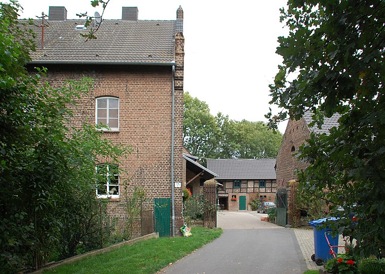
Sindorf station
Railway station

Photo: A.Savin, CC BY-SA 3.0.
Sindorf station is a train station in the town of Sindorf in the German state of North Rhine-Westphalia on the Cologne–Aachen high-speed railway. The station is in the south-east of the Kerpen district of Sindorf and has a side platform on the south side of the S-Bahn line. Sindorf station is situated 1 km southwest of Schulzentrum Horrem-Sindorf.
Burg Hemmersbach
Castle

Photo: A.Savin, CC BY-SA 3.0.
Burg Hemmersbach is a castle, which is situated 1¼ km northeast of Schulzentrum Horrem-Sindorf.
Jüdischer Friedhof
Cemetery
 Jüdischer Friedhof is a cemetery, which is situated 1 km northwest of Schulzentrum Horrem-Sindorf.
Places in the Area
Nearby places include Horrem and Sindorf.


Schulzentrum Horrem-Sindorf
- Type: Athletics track
- Categories: recreation area and sports location
- Location: Bergheim, Rhein-Erft-Kreis, Cologne District, North Rhine-Westphalia, Germany, Central Europe, Europe
- View on OpenStreetMap
Latitude
50.90931° or 50° 54′ 34″ northLongitude
6.69303° or 6° 41′ 35″ eastOpen location code
9F28WM5V+P6OpenStreetMap ID
way 49927299OpenStreetMap feature
leisure=trackOpenStreetMap feature
sport=multi
This page is based on OpenStreetMap, Wikidata, and Wikimedia Commons.
We’d love your help improving our open data sources. Thank you for contributing.
Satellite Map
Discover Schulzentrum Horrem-Sindorf from above in high-definition satellite imagery.
Notable Places Nearby
Highlights include Schulzentrum Horrem-Sindorf and Schulzentrum Horrem-Sindorf.
Nearby Places
Explore places such as Erftlagune and Realschule der Stadt Kerpen und Willy-Brandt-Gesamtschule.
North Rhine-Westphalia: Must-Visit Destinations
Delve into Cologne, Düsseldorf, Bonn, and Dortmund.
Curious Athletics Tracks to Discover
Uncover intriguing athletics tracks from every corner of the globe.
About Mapcarta. Data © OpenStreetMap contributors and available under the Open Database License". Text is available under the CC BY-SA 4.0 license, except for photos, directions, and the map. Photo: Daniel Schwen, CC BY-SA 2.5.