Hospital Militar de Área de Manaus
Hospital Militar de Área de Manaus is a hospital in Manaus, Amazonas. Hospital Militar de Área de Manaus is situated nearby to the college Serviço Nacional de Aprendizagem Social - SESI, as well as near the government building 13ª Inspetoria de Controle e Finança do Exército.| Tap on a place to explore it |
Places of Interest Nearby
Highlights include Amazon Theatre and Palácio Rio Negro.
Amazon Theatre
Theater building

Photo: Karine Hermes, CC BY-SA 4.0.
The Amazon Theatre is an opera house located in Manaus, Brazil, in the heart of the Amazon rainforest. It is the location of the annual Festival Amazonas de Ópera and the home of the Amazonas Philharmonic Orchestra which regularly rehearses and performs at the Amazon Theatre along with choirs, musical concerts and other performances. Amazon Theatre is situated 2 km west of Hospital Militar de Área de Manaus.
Palácio Rio Negro
Museum
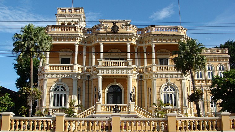
Photo: Madison, CC BY-SA 3.0.
The Palácio Rio Negro in Manaus, Brazil, is a former seat of government and residence of the governor of the state of Amazonas. The original name was Scholz Palace, built by the German entrepreneur Karl Waldemar Scholz, who was considered to be a "Rubber Baron". Palácio Rio Negro is situated 1¼ km west of Hospital Militar de Área de Manaus.
Church of Saint Sebastian
Church

Photo: Wikimedia, Public domain.
The Church of Saint Sebastian is a religious temple owned by the Archdiocese of Manaus. It is located on 10 de Julho Street and its main facade faces the Largo de São Sebastião, in the center of the city of Manaus. Church of Saint Sebastian is situated 2 km west of Hospital Militar de Área de Manaus.
Places in the Area
Nearby places include São Raimundo and Chapada.
São Raimundo
Suburb

Photo: Lucelio Moreira, CC BY-SA 3.0.
São Raimundo is a suburb, which is situated 4 km west of Hospital Militar de Área de Manaus.
Chapada
Suburb

Photo: Ben Sutherland, CC BY 2.0.
Chapada is an upper middle class neighborhood in the South-Central Zone of Manaus, Amazonas. Chapada is situated 5 km northwest of Hospital Militar de Área de Manaus.
Hospital Militar de Área de Manaus
- Type: Hospital
- Category: health care
- Location: Manaus, Amazonas, North, Brazil, South America
- View on OpenStreetMap
Latitude
-3.13096° or 3° 7′ 52″ southLongitude
-60.00568° or 60° 0′ 20″ westOpen location code
678XVX9V+JPOpenStreetMap ID
way 510539654OpenStreetMap feature
amenity=hospitalOpenStreetMap feature
healthcare=hospital
This page is based on OpenStreetMap, Wikidata, and Wikimedia Commons.
We’d love your help improving our open data sources. Thank you for contributing.
Satellite Map
Discover Hospital Militar de Área de Manaus from above in high-definition satellite imagery.
Notable Places Nearby
Highlights include Serviço Nacional de Aprendizagem Social - SESI and 13ª Inspetoria de Controle e Finança do Exército.
Nearby Places
Explore places such as Vila Militar and Via Marconi.
Amazonas: Must-Visit Destinations
Delve into Jaú National Park, Parintins, São Gabriel da Cachoeira, and Tefé.
Curious Places to Discover
Uncover intriguing places from every corner of the globe.
About Mapcarta. Data © OpenStreetMap contributors and available under the Open Database License". Text is available under the CC BY-SA 4.0 license, except for photos, directions, and the map. Photo: Bruno.karklis, CC BY-SA 3.0.