Hospiz am Drachenkopf
Hospiz am Drachenkopf is a social service facility in Eberswalde, Barnim, Brandenburg which is located on Erich-Mühsam-Straße. Hospiz am Drachenkopf is situated nearby to the scenic viewpoint Aussichtspunkt am Drachenkopf, as well as near the church Bethel-Gemeinde Eberswalde.| Tap on a place to explore it |
Places of Interest Nearby
Highlights include Maria-Magdalenen-Kirche (Eberswalde) and Paul-Wunderlich-Haus.
Maria-Magdalenen-Kirche (Eberswalde)
Church

Photo: Ralf Roletschek, GFDL.
Maria-Magdalenen-Kirche (Eberswalde) is a church, which is situated 300 metres north of Hospiz am Drachenkopf.
Paul-Wunderlich-Haus
Community center
 Paul-Wunderlich-Haus is a community center, which is situated 400 metres north of Hospiz am Drachenkopf.
Löwenbrunnen
Fountain
 Löwenbrunnen is a fountain, which is situated 440 metres north of Hospiz am Drachenkopf.
Places in the Area
Nearby places include Tornow and Lichterfelde.
Tornow
Village
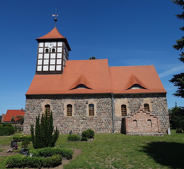
Photo: Hans G. Oberlack, CC BY-SA 4.0.
Tornow is a village, which is situated 5 km east of Hospiz am Drachenkopf.
Lichterfelde
Village

Photo: Hans G. Oberlack, CC BY-SA 4.0.
Lichterfelde is a village, which is situated 6 km northwest of Hospiz am Drachenkopf.
Britz
Village
 Britz is a municipality in the district of Barnim in Brandenburg in north-eastern Germany. Britz is situated 6 km north of Hospiz am Drachenkopf.
Hospiz am Drachenkopf
- Type: Social service facility
- Address: Erich-Mühsam-Straße 17, Eberswalde 1, Eberswalde, 16225
- Location: Eberswalde, Barnim, Brandenburg, Germany, Central Europe, Europe
- View on OpenStreetMap
Latitude
52.82953° or 52° 49′ 46″ northLongitude
13.82024° or 13° 49′ 13″ eastOperator
Evangelischer Verein “Auf dem Drachenkopf” e.V.Open location code
9F4MRRHC+R3OpenStreetMap ID
way 511130198OpenStreetMap feature
amenity=social_facility
This page is based on OpenStreetMap, Wikidata, and Wikimedia Commons.
We’d love your help improving our open data sources. Thank you for contributing.
Satellite Map
Discover Hospiz am Drachenkopf from above in high-definition satellite imagery.
Notable Places Nearby
Highlights include Aussichtspunkt am Drachenkopf and Bethel-Gemeinde Eberswalde.
Nearby Places
Explore places such as Korschis Fahrschule and Evangelisches Seniorenzentrum Hanna-Heim.
Brandenburg: Must-Visit Destinations
Delve into Potsdam, Cottbus, Frankfurt an der Oder, and Brandenburg an der Havel.
Curious Social Service Facilities to Discover
Uncover intriguing social service facilities from every corner of the globe.
About Mapcarta. Data © OpenStreetMap contributors and available under the Open Database License". Text is available under the CC BY-SA 4.0 license, except for photos, directions, and the map. Photo: Leviathan1983, CC BY-SA 3.0.