Landratamt Oder-Spree, Haus E
Landratamt Oder-Spree, Haus E is an office building in Beeskow, Oder-Spree, Brandenburg which is located on Breitscheidstraße. Landratamt Oder-Spree, Haus E is situated nearby to the government office Umweltamt, as well as near Bauordnungsamt.| Tap on a place to explore it |
Places of Interest Nearby
Highlights include Rouanet-Gymnasium Beeskow and Sowjetischer Ehrenfriedhof.
Rouanet-Gymnasium Beeskow
School

Photo: J.-H. Janßen, CC BY-SA 4.0.
Rouanet-Gymnasium Beeskow is a school, which is situated 160 metres north of Landratamt Oder-Spree, Haus E.
Sowjetischer Ehrenfriedhof
Cemetery

Photo: J.-H. Janßen, CC BY-SA 4.0.
Sowjetischer Ehrenfriedhof is a cemetery, which is situated 210 metres northeast of Landratamt Oder-Spree, Haus E.
The oldest house in Beeskow

Photo: MOs810, CC BY-SA 4.0.
The oldest house in Beeskow is situated 530 metres northeast of Landratamt Oder-Spree, Haus E.
Places in the Area
Nearby places include Beeskow and Bahrensdorf.
Beeskow
Town
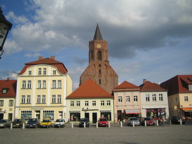
Photo: Gt-man, CC BY-SA 2.0 de.
Beeskow is a town in Brandenburg, in eastern Germany, and capital of the Oder-Spree district. It is situated on the river Spree, 30 km southwest of Frankfurt an der Oder.

Bornow
Village

Photo: Clemensfranz, CC BY-SA 3.0.
Bornow is a village, which is situated 3 km west of Landratamt Oder-Spree, Haus E.
Landratamt Oder-Spree, Haus E
- Type: Office building
- Address: Breitscheidstraße 5, Beeskow, 15848
- Categories: building and office
- Location: Beeskow, Oder-Spree, Brandenburg, Germany, Central Europe, Europe
- View on OpenStreetMap
Latitude
52.16816° or 52° 10′ 5″ northLongitude
14.24233° or 14° 14′ 32″ eastOpen location code
9F4P569R+7WOpenStreetMap ID
way 51138983OpenStreetMap feature
building=office
This page is based on OpenStreetMap, Wikidata, and Wikimedia Commons.
We’d love your help improving our open data sources. Thank you for contributing.
Satellite Map
Discover Landratamt Oder-Spree, Haus E from above in high-definition satellite imagery.
Notable Places Nearby
Highlights include Umweltamt and Bauordnungsamt.
Nearby Places
Explore places such as Landratamt Oder-Spree, Haus F and Denkmal.
Brandenburg: Must-Visit Destinations
Delve into Potsdam, Cottbus, Frankfurt an der Oder, and Brandenburg an der Havel.
Curious Office Buildings to Discover
Uncover intriguing office buildings from every corner of the globe.
About Mapcarta. Data © OpenStreetMap contributors and available under the Open Database License". Text is available under the CC BY-SA 4.0 license, except for photos, directions, and the map. Photo: Leviathan1983, CC BY-SA 3.0.