Mănăstirea Sfântul Ioan Botezătorul
Mănăstirea Sfântul Ioan Botezătorul is a church in Alba Iulia, Alba County which is located on Strada Valea Călugărului. Mănăstirea Sfântul Ioan Botezătorul is situated nearby to the suburb Bărăbanț, as well as near the village Șard.| Tap on a place to explore it |
Places of Interest Nearby
Highlights include St. Michael’s Cathedral and Cetate Stadium.
St. Michael’s Cathedral
Church

Photo: Rabanus Flavus, CC BY-SA 3.0.
St. Michael's Cathedral is the cathedral of the Roman Catholic Archdiocese of Alba Iulia, Romania, and is the oldest and longest cathedral in the country. St. Michael’s Cathedral is situated 2½ km southeast of Mănăstirea Sfântul Ioan Botezătorul.
Cetate Stadium
Stadium
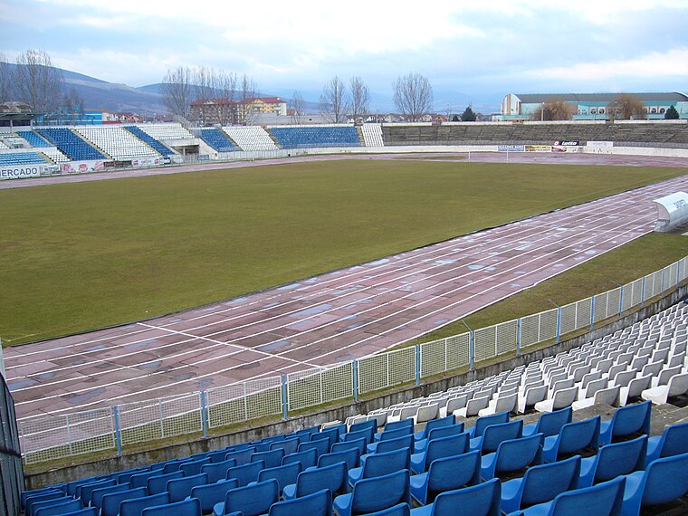
Photo: Wikimedia, Public domain.
The Cetate Stadium is a multi-purpose stadium in Alba Iulia, Romania. It is currently used mostly for football matches and is the home ground of Unirea Alba Iulia. The stadium holds 18,000 people. Cetate Stadium is situated 1½ km southeast of Mănăstirea Sfântul Ioan Botezătorul.
Reunification Cathedral
Church

Photo: Danielusz, CC BY-SA 3.0 ro.
The Coronation Cathedral, dedicated to the Holy Trinity and the Holy Archangels Michael and Gabriel, is a Romanian Orthodox cathedral located at 16 Mihai Viteazul Street, Alba Iulia, Romania. Reunification Cathedral is situated 2½ km southeast of Mănăstirea Sfântul Ioan Botezătorul.
Places in the Area
Nearby places include Bărăbanț and Șard.
Bărăbanț
Suburb

Photo: Țetcu Mircea Rareș, CC BY-SA 4.0.
Bărăbanț is a suburb, which is situated 3½ km northeast of Mănăstirea Sfântul Ioan Botezătorul.
Șard
Village

Photo: Ciprian Lazar, CC BY-SA 2.0.
Șard is a village, which is situated 4½ km north of Mănăstirea Sfântul Ioan Botezătorul.
Oarda
Village
 Oarda is a village, which is situated 6 km south of Mănăstirea Sfântul Ioan Botezătorul.
Mănăstirea Sfântul Ioan Botezătorul
- Type: Church
- Address: Strada Valea Călugărului 10, Alba Iulia, 510310
- Categories: building and religion
- Location: Alba Iulia, Alba County, Transylvania, Romania, Balkans, Europe
- View on OpenStreetMap
Latitude
46.08506° or 46° 5′ 6″ northLongitude
23.5463° or 23° 32′ 47″ eastOpen location code
8GR53GPW+2GOpenStreetMap ID
way 513624286OpenStreetMap feature
building=church
This page is based on OpenStreetMap, Wikidata, and Wikimedia Commons.
We’d love your help improving our open data sources. Thank you for contributing.
Satellite Map
Discover Mănăstirea Sfântul Ioan Botezătorul from above in high-definition satellite imagery.
Notable Places Nearby
Highlights include Mănăstirea Sfântul Ioan Botezătorul - Alba Iulia and Parcul Dendrologic Alba-Iulia.
Nearby Places
Explore places such as S.C. Continentour S.R.L and Bl.3.
Alba County: Must-Visit Destinations
Delve into Blaj, Aiud, Roșia Montană, and Baia de Arieș.
Curious Churches to Discover
Uncover intriguing churches from every corner of the globe.
About Mapcarta. Data © OpenStreetMap contributors and available under the Open Database License". Text is available under the CC BY-SA 4.0 license, except for photos, directions, and the map. Photo: LilianaWW, CC BY-SA 3.0.