Franz Stettner & Sohn GmbH
Franz Stettner & Sohn GmbH is a building in Kolbermoor, Rosenheim, Bavaria. Franz Stettner & Sohn GmbH is situated nearby to the health club Clever fit, as well as near Kampfsport Kornhass.| Tap on a place to explore it |
Places of Interest Nearby
Highlights include Heimat- und Industriemuseum and Kolbermoor station.
Heimat- und Industriemuseum
Museum
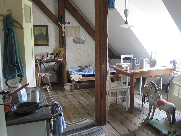
Photo: Edelmauswaldgeist, CC0.
Heimat- und Industriemuseum is situated 800 metres west of Franz Stettner & Sohn GmbH.
Kolbermoor station
Railway station
 Kolbermoor station is a railway station, which is situated 1 km west of Franz Stettner & Sohn GmbH.
Stolperstein dedicated to Fortunato Zanobini
Memorial

Photo: Wikimedia, CC BY-SA 4.0.
Stolperstein dedicated to Fortunato Zanobini is a memorial, which is situated 520 metres west of Franz Stettner & Sohn GmbH.
Places in the Area
Nearby places include Kolbermoor and Pang.
Kolbermoor
Town

Photo: Rufus46, CC BY-SA 3.0.
Kolbermoor is a town in the district of Rosenheim, in Bavaria, Germany. It is situated 5 km west of Rosenheim on the river Mangfall. In 1859 Kolbermoor railway stop was built for the new Bavarian Maximilian's Railway.
Pang
Village

Photo: Rufus46, CC BY-SA 3.0.
Pang is a village, which is situated 3½ km southeast of Franz Stettner & Sohn GmbH.
Aising
Suburb

Photo: Rufus46, CC BY-SA 3.0.
Aising is a suburb, which is situated 3½ km southeast of Franz Stettner & Sohn GmbH.
Franz Stettner & Sohn GmbH
- Type: Commercial building
- Categories: building and office
- Location: Kolbermoor, Rosenheim, Upper Bavaria, Bavaria, Germany, Central Europe, Europe
- View on OpenStreetMap
Latitude
47.85109° or 47° 51′ 4″ northLongitude
12.07524° or 12° 4′ 31″ eastOpen location code
8FVJV32G+C3OpenStreetMap ID
way 521635754OpenStreetMap feature
building=commercial
This page is based on OpenStreetMap, Wikidata, and Wikimedia Commons.
We’d love your help improving our open data sources. Thank you for contributing.
Satellite Map
Discover Franz Stettner & Sohn GmbH from above in high-definition satellite imagery.
Notable Places Nearby
Highlights include Clever fit and Kampfsport Kornhass.
Nearby Places
Explore places such as Gewerbegebiet Rosenheimer Straße and Kolbermoor, Am Graben.
Upper Bavaria: Must-Visit Destinations
Delve into Munich, Ingolstadt, Rosenheim, and Dachau.
Curious Places to Discover
Uncover intriguing places from every corner of the globe.
About Mapcarta. Data © OpenStreetMap contributors and available under the Open Database License". Text is available under the CC BY-SA 4.0 license, except for photos, directions, and the map. Photo: Aconcagua, CC BY-SA 3.0.