Kinderfreundeheim Mösli
Kinderfreundeheim Mösli is a building in Stallikon, Affoltern District, Canton of Zurich which is located on Möslistrasse. Kinderfreundeheim Mösli is situated nearby to the peak Felsenegg, as well as near the hamlet Aumüli.| Tap on a place to explore it |
Places of Interest Nearby
Highlights include Felsenegg and Baldern Castle.
Felsenegg
Peak

Photo: Parpan05, CC BY-SA 3.0.
Felsenegg is a vantage point in the canton of Zürich in Switzerland.
Baldern Castle
Archaeological site

Photo: Wikimedia, CC BY-SA 3.0.
Baldern Castle is a former castle in the municipality of Stallikon and the canton of Zürich in Switzerland. The remains of the castle comprise a set of earthworks, situated on the Albis ridge at some 810 metres above sea level and about 4 kilometres south of the summit of Uetliberg. Baldern Castle is situated 1 km northeast of Kinderfreundeheim Mösli.
Mill with Outbuildings
Watermill

Photo: Paebi, CC BY-SA 3.0.
Mill with Outbuildings is a watermill, which is situated 1 km southwest of Kinderfreundeheim Mösli.
Places in the Area
Nearby places include Aumüli and Adliswil.

Adliswil
Town
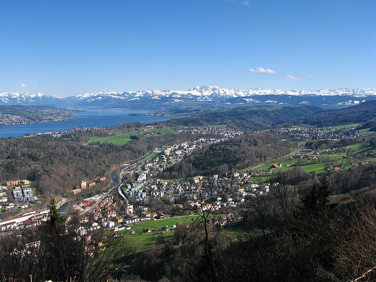
Photo: Roland zh, CC BY-SA 3.0.
Adliswil is a town and a municipality in the district of Horgen in the canton of Zürich in Switzerland. The official language of Adliswil is German, but the main spoken language is the local variant of the Alemannic Swiss German dialect.
Bonstetten
Village

Photo: Paebi, CC BY-SA 3.0.
Bonstetten is a village in the district of Affoltern in the canton of Zürich in Switzerland.
Kinderfreundeheim Mösli
- Type: Building
- Address: Möslistrasse 50, Stallikon, 8143
- Location: Stallikon, Affoltern District, Canton of Zurich, Switzerland, Central Europe, Europe
- View on OpenStreetMap
Latitude
47.30708° or 47° 18′ 26″ northLongitude
8.49667° or 8° 29′ 48″ eastOpen location code
8FVC8F4W+RMOpenStreetMap ID
way 52705282OpenStreetMap feature
building=yes
This page is based on OpenStreetMap, Wikidata, and Wikimedia Commons.
We’d love your help improving our open data sources. Thank you for contributing.
Satellite Map
Discover Kinderfreundeheim Mösli from above in high-definition satellite imagery.
Notable Places Nearby
Highlights include Fischer and Baldern.
Nearby Places
Explore places such as Stiftung Puureheimet Brotchorb and Stiftung Puureheimet Brootchorb.
Switzerland: Must-Visit Destinations
Delve into Zurich, Berne, Geneva, and Basel.
Curious Buildings to Discover
Uncover intriguing buildings from every corner of the globe.
About Mapcarta. Data © OpenStreetMap contributors and available under the Open Database License". Text is available under the CC BY-SA 4.0 license, except for photos, directions, and the map. Photo: Roland zh, CC BY-SA 3.0.