FB Wald und Umwelt
FB Wald und Umwelt is a college building in Brandenburg, Germany. FB Wald und Umwelt is situated nearby to the university Waldcampus Hochschule für nachhaltige Entwicklung Eberswalde, as well as near the athletics track Tierweitsprung.| Tap on a place to explore it |
- Type: College building
- Also known as: “Haus 11”
- Roof shape: gabled
Places of Interest Nearby
Highlights include Märchenvilla and Paul-Wunderlich-Haus.
Märchenvilla
Public building
 Märchenvilla is a public building, which is situated 310 metres north of FB Wald und Umwelt.
Paul-Wunderlich-Haus
Community center
 Paul-Wunderlich-Haus is a community center, which is situated 1 km northeast of FB Wald und Umwelt.
Maria-Magdalenen-Kirche (Eberswalde)
Church

Photo: Ralf Roletschek, GFDL.
Maria-Magdalenen-Kirche (Eberswalde) is a church, which is situated 1 km northeast of FB Wald und Umwelt.
Places in the Area
Nearby places include Eberswalde and Tornow.
Eberswalde
 Eberswalde is a major town and the administrative seat of the district Barnim in Brandenburg in north-eastern Germany, about 50 km northeast of Berlin.
Tornow
Village
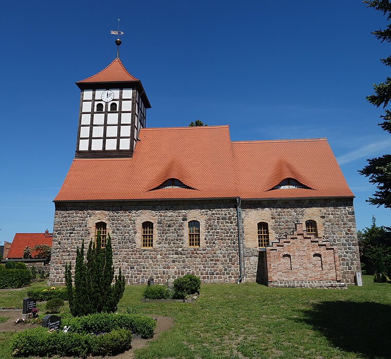
Photo: Hans G. Oberlack, CC BY-SA 4.0.
Tornow is a village, which is situated 5 km east of FB Wald und Umwelt.
Lichterfelde
Village

Photo: Hans G. Oberlack, CC BY-SA 4.0.
Lichterfelde is a village, which is situated 6 km northwest of FB Wald und Umwelt.
FB Wald und Umwelt
- Categories: building and education
- Location: Brandenburg, Germany, Central Europe, Europe
- View on OpenStreetMap
Latitude
52.82551° or 52° 49′ 32″ northLongitude
13.81072° or 13° 48′ 39″ eastOperator
HNE EberswaldeOpen location code
9F4MRRG6+67OpenStreetMap ID
way 53047641OpenStreetMap feature
building=collegeOpenStreetMap attribute
roof-shape=gabled
This page is based on OpenStreetMap, Wikidata, and Wikimedia Commons.
We’d love your help improving our open data sources. Thank you for contributing.
Satellite Map
Discover FB Wald und Umwelt from above in high-definition satellite imagery.
Notable Places Nearby
Highlights include Waldcampus Hochschule für nachhaltige Entwicklung Eberswalde and Tierweitsprung.
Nearby Places
Explore places such as Thünen-Institut für Waldökosysteme and Mensa.
Brandenburg: Must-Visit Destinations
Delve into Potsdam, Cottbus, Frankfurt an der Oder, and Brandenburg an der Havel.
Curious Places to Discover
Uncover intriguing places from every corner of the globe.
About Mapcarta. Data © OpenStreetMap contributors and available under the Open Database License". Text is available under the CC BY-SA 4.0 license, except for photos, directions, and the map. Photo: Leviathan1983, CC BY-SA 3.0.