Sandwagen
Sandwagen is a building in Offenburg, Ortenaukreis, Baden-Württemberg. Sandwagen is situated nearby to the chapel Aussegnungshalle, as well as near the cemetery Friedhof Elgersweier.| Tap on a place to explore it |
Places of Interest Nearby
Highlights include Ortenberg Castle and Menhir von Ortenberg.
Ortenberg Castle
Castle

Photo: Carsten Steger, CC BY-SA 4.0.
Ortenberg Castle is the main landmark of the Ortenau and is situated above the town of Ortenberg at the end of the Kinzig Valley between Offenburg and Gengenbach. Ortenberg Castle is situated 1½ km east of Sandwagen.
Menhir von Ortenberg
Stone

Photo: Sir Lucan, CC BY-SA 3.0.
Menhir von Ortenberg is a stone, which is situated 2 km east of Sandwagen.
St. Bartholomäus
Church
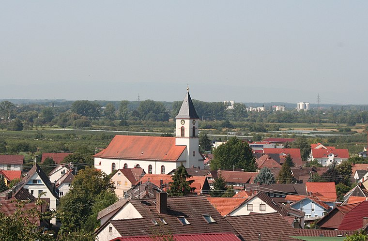
Photo: Wikimedia, CC BY-SA 3.0.
St. Bartholomäus is a church, which is situated 2 km northeast of Sandwagen.
Places in the Area
Nearby places include Ortenberg and Gengenbach.
Ortenberg
Village

Photo: Lekthor, CC BY-SA 3.0.
Ortenberg is a municipality in the district of Ortenaukreis, Baden-Württemberg.
Gengenbach

Photo: Gargolla, CC BY-SA 3.0.
Gengenbach is an historic town delightfully set in the Kinzigtal of the Black Forest and boasting romantic half timbered houses in narrow streets in the style of the Romantic Road.
Durbach
Village

Photo: Stephan.de, CC BY-SA 3.0.
Durbach is a municipality in the district of Ortenau in Baden-Württemberg in Germany. It is situated on the verge of the northern Black Forest Mountains six kilometers north east of the town of Offenburg. Durbach is situated 8 km northeast of Sandwagen.
Sandwagen
- Type: Canopy
- Categories: building, historic site, and technical monument
- Location: Offenburg, Ortenaukreis, Freiburg Region, Black Forest, Baden-Württemberg, Germany, Central Europe, Europe
- View on OpenStreetMap
Latitude
48.44142° or 48° 26′ 29″ northLongitude
7.95154° or 7° 57′ 6″ eastOpen location code
8FW9CXR2+HJOpenStreetMap ID
way 531236954OpenStreetMap feature
building=roofOpenStreetMap feature
historic=technical_monument
This page is based on OpenStreetMap, Wikidata, and Wikimedia Commons.
We’d love your help improving our open data sources. Thank you for contributing.
Satellite Map
Discover Sandwagen from above in high-definition satellite imagery.
Notable Places Nearby
Highlights include Aussegnungshalle and Friedhof Elgersweier.
Nearby Places
Explore places such as Kindertagesstätte Elgersweier and Kriegerdenkmal.
Black Forest: Must-Visit Destinations
Delve into Freiburg, Baden-Baden, Pforzheim, and Villingen-Schwenningen.
Curious Places to Discover
Uncover intriguing places from every corner of the globe.
About Mapcarta. Data © OpenStreetMap contributors and available under the Open Database License". Text is available under the CC BY-SA 4.0 license, except for photos, directions, and the map. Photo: Llez, CC BY-SA 3.0.