Cité Administrative Bruand
Cité Administrative Bruand is an office building in Besançon, Doubs, Bourgogne-Franche-Comté. Cité Administrative Bruand is situated nearby to the prison Centre de semi-liberté de Besançon, as well as near the government office DREAL.| Tap on a place to explore it |
Places of Interest Nearby
Highlights include Besançon-Viotte station and Synagogue of Besançon.
Besançon-Viotte station
Railway station

Photo: Niamor12, CC BY-SA 4.0.
Besançon–Viotte is the main railway station located in Besançon, Doubs, eastern France. The station was opened in 1855 and is located on the Dole–Belfort railway, Besançon–Le Locle railway and Besançon-Viotte-Vesoul railway. Besançon-Viotte station is situated 310 metres south of Cité Administrative Bruand.
Synagogue of Besançon
Synagogue

Photo: GFreihalter, CC BY-SA 3.0.
The Synagogue of Besançon is a Jewish congregation and synagogue, located at 23 Quai de Strasbourg, in the Battant area, near the old part of town, in the city of Besançon, in the Bourgogne-Franche-Comté region of France. Synagogue of Besançon is situated 1 km south of Cité Administrative Bruand.
Musée des Beaux-Arts et d’Archéologie de Besançon
Museum
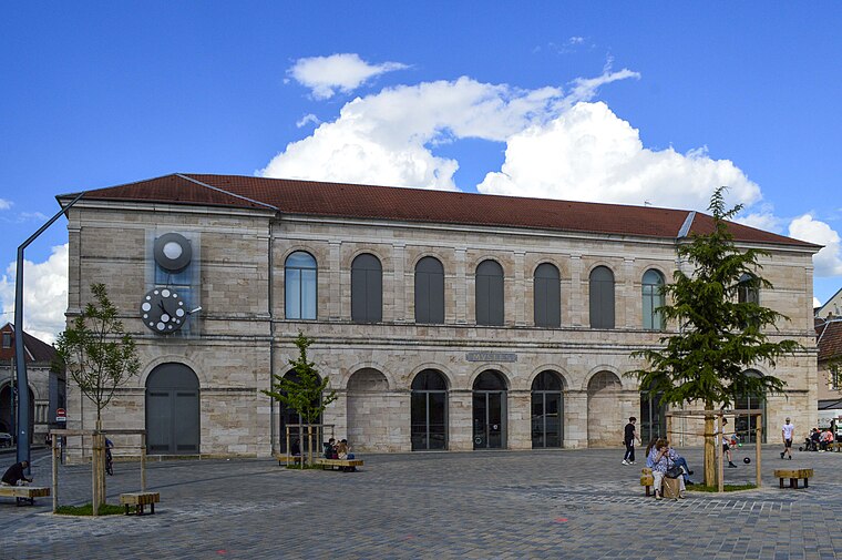
Photo: Wikipedro, CC BY-SA 4.0.
The musée des Beaux-Arts et d'Archéologie in the French city of Besançon is the oldest public museum in France. It was set up in 1694, nearly a century before the Louvre became a public museum. Musée des Beaux-Arts et d’Archéologie de Besançon is situated 1 km south of Cité Administrative Bruand.
Places in the Area
Nearby places include Saint-Claude and Battant.
Battant
Suburb
Battant is one of the oldest parts of Besançon, Doubs, France, and has been under architectural protection since 1964. It is situated on the right bank of the river Doubs, north of the ox-bow that encircles the center of the city.
Vaites
Quarter
Vaites or The Vaites is a district of Besançon, located to the northeast of the city.
Cité Administrative Bruand
- Type: Office building
- Categories: building and office
- Location: Besançon, Arrondissement of Besançon, Doubs, Franche-Comté, Bourgogne-Franche-Comté, France, Europe
- View on OpenStreetMap
Latitude
47.24981° or 47° 14′ 59″ northLongitude
6.02243° or 6° 1′ 21″ eastOpen location code
8FV862XC+WXOpenStreetMap ID
way 53820731OpenStreetMap feature
building=office
This page is based on OpenStreetMap, Wikidata, and Wikimedia Commons.
We’d love your help improving our open data sources. Thank you for contributing.
Satellite Map
Discover Cité Administrative Bruand from above in high-definition satellite imagery.
Notable Places Nearby
Highlights include Centre de semi-liberté de Besançon and DREAL.
Nearby Places
Explore places such as LP Bernard Cordier and École privée de Coiffure Cordier.
Franche-Comté: Must-Visit Destinations
Delve into Vesoul, Dole, Saint-Claude, and Nans-sous-Sainte-Anne.
Curious Office Buildings to Discover
Uncover intriguing office buildings from every corner of the globe.
About Mapcarta. Data © OpenStreetMap contributors and available under the Open Database License". Text is available under the CC BY-SA 4.0 license, except for photos, directions, and the map. Photo: Ludo29, CC BY-SA 3.0.