Trinkwasserbrunnen Stadt Voitsberg
Trinkwasserbrunnen Stadt Voitsberg is a building in Voitsberg, Styria which is located on Rottenbachergasse. Trinkwasserbrunnen Stadt Voitsberg is situated nearby to the meadow Trinkwasserschutzgebiet, as well as near the pitch Pumptrack Voitsberg.| Tap on a place to explore it |
Places of Interest Nearby
Highlights include Stadtpfarrkirche Voitsberg and Oberjäger-Kapelle, Bärnbach.
Stadtpfarrkirche Voitsberg
Church
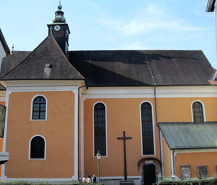
Photo: Wikimedia, CC BY-SA 3.0 at.
Stadtpfarrkirche Voitsberg is a church, which is situated 380 metres east of Trinkwasserbrunnen Stadt Voitsberg.
Oberjäger-Kapelle, Bärnbach
Wayside shrine

Photo: Steinbergjohann, CC BY-SA 3.0 at.
Oberjäger-Kapelle, Bärnbach is a wayside shrine, which is situated 490 metres north of Trinkwasserbrunnen Stadt Voitsberg.
Pfarrhof Voitsberg
Building

Photo: Wikimedia, CC BY-SA 3.0 at.
Pfarrhof Voitsberg is a building, which is situated 360 metres east of Trinkwasserbrunnen Stadt Voitsberg.
Places in the Area
Nearby places include Piberegg and Södingberg.
Piberegg
Village
Piberegg is a former municipality in the district of Voitsberg in the Austrian state of Styria. Since the 2015 Styria municipal structural reform, it is part of the municipality Bärnbach. Piberegg is situated 5 km north of Trinkwasserbrunnen Stadt Voitsberg.
Södingberg
Village
Södingberg is a former municipality in the district of Voitsberg in the Austrian state of Styria. Since the 2015 Styria municipal structural reform, it is part of the municipality Geistthal-Södingberg. Södingberg is situated 7 km northeast of Trinkwasserbrunnen Stadt Voitsberg.
Kohlschwarz
Hamlet
Kohlschwarz is a former municipality in the district of Voitsberg in the Austrian state of Styria. Since the 2015 Styria municipal structural reform, it is part of the municipality Kainach bei Voitsberg. Kohlschwarz is situated 8 km north of Trinkwasserbrunnen Stadt Voitsberg.
Trinkwasserbrunnen Stadt Voitsberg
- Type: Building
- Address: Rottenbachergasse, Voitsberg, 8570
- Location: Voitsberg, Voitsberg District, Styria, Austria, Central Europe, Europe
- View on OpenStreetMap
Latitude
47.0508° or 47° 3′ 3″ northLongitude
15.13855° or 15° 8′ 19″ eastOpen location code
8FVQ342Q+8COpenStreetMap ID
way 539263440OpenStreetMap feature
building=yes
This page is based on OpenStreetMap, Wikidata, and Wikimedia Commons.
We’d love your help improving our open data sources. Thank you for contributing.
Satellite Map
Discover Trinkwasserbrunnen Stadt Voitsberg from above in high-definition satellite imagery.
Notable Places Nearby
Highlights include Trinkwasserschutzgebiet and Pumptrack Voitsberg.
Nearby Places
Explore places such as Bauhof and LEOPOLD Bistro by cooktrio.
Styria: Must-Visit Destinations
Delve into Graz, Leoben, Bruck an der Mur, and Kapfenberg.
Curious Buildings to Discover
Uncover intriguing buildings from every corner of the globe.
About Mapcarta. Data © OpenStreetMap contributors and available under the Open Database License". Text is available under the CC BY-SA 4.0 license, except for photos, directions, and the map. Photo: Kmarka, CC BY-SA 3.0.