Centre d’incendie et de secours de Nogent-sur-Vernisson
Centre d’incendie et de secours de Nogent-sur-Vernisson is a fire station in Nogent-sur-Vernisson, Arrondissement of Montargis, Centre-Val de Loire which is located on Rue Georges Bannery. Centre d’incendie et de secours de Nogent-sur-Vernisson is situated nearby to the railway station Nogent-sur-Vernisson station, as well as near the post office La Poste.| Tap on a place to explore it |
- Type: Fire station
- Also known as: “CS Nogent-sur-Vernisson”
- Address: 104 Rue Georges Bannery, Nogent-sur-Vernisson, 45290
Places of Interest Nearby
Highlights include Nogent-sur-Vernisson station and Église de Nogent-sur-Vernisson.
Nogent-sur-Vernisson station
Railway station
 Nogent-sur-Vernisson is a railway station in Nogent-sur-Vernisson, Centre-Val de Loire, France. The station is located on the Moret-Lyon railway. The station is served by Intercités services operated by SNCF between Paris and Nevers. Nogent-sur-Vernisson station is situated 380 metres southwest of Centre d’incendie et de secours de Nogent-sur-Vernisson.
Église de Nogent-sur-Vernisson
Church

Photo: François GOGLINS, CC BY-SA 4.0.
Église de Nogent-sur-Vernisson is a church, which is situated 1 km south of Centre d’incendie et de secours de Nogent-sur-Vernisson.
Arboretum national des Barres
Garden

Photo: Calips, CC BY-SA 1.0.
The Arboretum national des Barres is a national arboretum located in Nogent-sur-Vernisson, Loiret, Centre-Val de Loire, France. It is open daily in the warmer months; an admission fee is charged. Arboretum national des Barres is situated 2½ km southeast of Centre d’incendie et de secours de Nogent-sur-Vernisson.
Places in the Area
Nearby places include Montbouy and Châtillon-Coligny.
Montbouy
Village
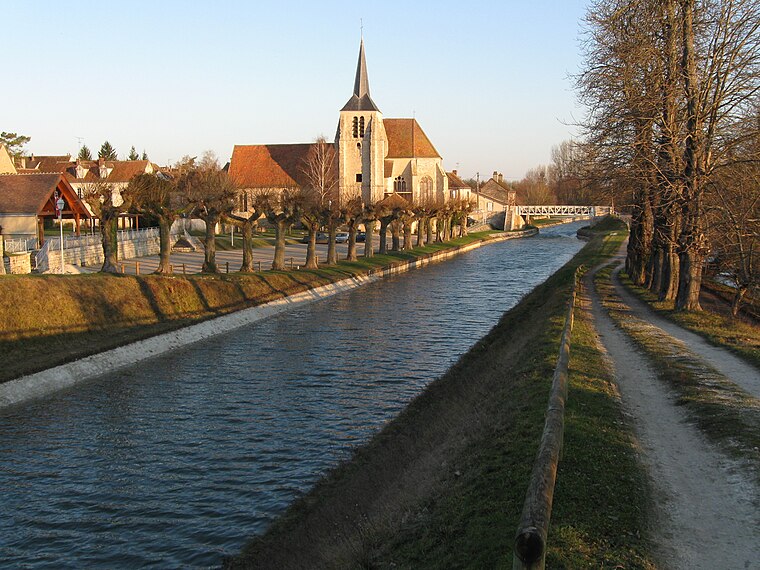
Photo: Alvaro, CC BY-SA 3.0.
Montbouy is a commune in the Loiret department in north-central France. Montbouy is situated 6 km east of Centre d’incendie et de secours de Nogent-sur-Vernisson.
Châtillon-Coligny
Village

Photo: Alvaro, CC BY-SA 3.0.
Châtillon-Coligny is a commune in the Loiret department in north-central France. The Loing and the Briare Canal run through the town. Châtillon-Coligny is situated 9 km southeast of Centre d’incendie et de secours de Nogent-sur-Vernisson.
Centre d’incendie et de secours de Nogent-sur-Vernisson
Latitude
47.85535° or 47° 51′ 19″ northLongitude
2.74091° or 2° 44′ 27″ eastOperator
SDIS 45Open location code
8FV4VP4R+49OpenStreetMap ID
way 543102071OpenStreetMap feature
amenity=fire_station
This page is based on OpenStreetMap, Wikidata, and Wikimedia Commons.
We’d love your help improving our open data sources. Thank you for contributing.
Satellite Map
Discover Centre d’incendie et de secours de Nogent-sur-Vernisson from above in high-definition satellite imagery.
Notable Places Nearby
Highlights include La Poste and Aire Camping-car Nogent-sur-Vernisson.
Nearby Places
Explore places such as bi1 and Garage Meunier.
Centre-Val de Loire: Must-Visit Destinations
Delve into Orléans, Tours, Chartres, and Bourges.
Curious Fire Stations to Discover
Uncover intriguing fire stations from every corner of the globe.
About Mapcarta. Data © OpenStreetMap contributors and available under the Open Database License". Text is available under the CC BY-SA 4.0 license, except for photos, directions, and the map. Photo: PMRMaeyaert, CC BY-SA 3.0.