Liroschule
Liroschule is a school in Augsburg, Bavarian Swabia, Bavaria which is located on Färberstraße. Liroschule is situated nearby to the marketplace Wochenmarkt, as well as near the health club WingTsun Selbstverteidigung und Gesundheitsschule.| Tap on a place to explore it |
- Type: School
- Also known as: “Lichtenstein-Rother-Volksschule”
- Address: Färberstraße 2, Augsburg, 86157
Places of Interest Nearby
Highlights include Stadtpfarrkirche Herz-Jesu and Rosenaustadion.
Stadtpfarrkirche Herz-Jesu
Church
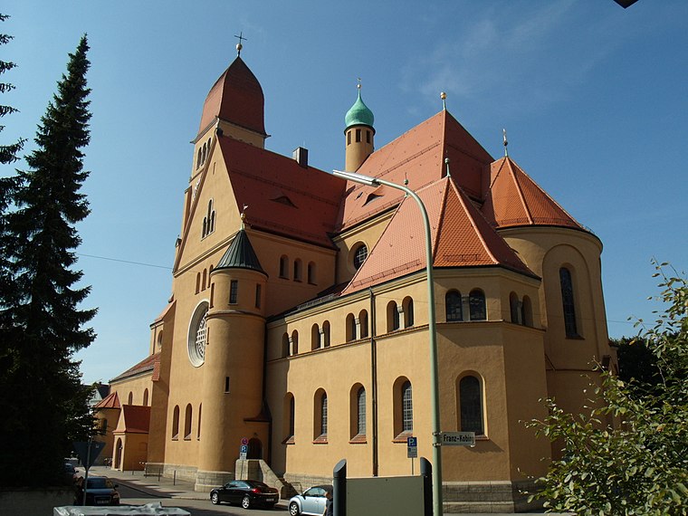
Photo: Richard Mayer, CC BY-SA 3.0.
Stadtpfarrkirche Herz-Jesu is a church, which is situated 190 metres northwest of Liroschule.
Rosenaustadion
Stadium
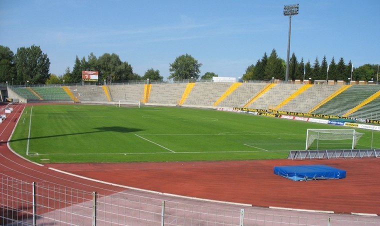
Photo: Wikimedia, CC BY-SA 3.0.
Rosenaustadion is a multi-purpose stadium in Augsburg, Bavaria, Germany. Built in 1951, it is a heritage listed monument and was the largest stadium in Augsburg for 58 years until 2009 when the Augsburg Arena was opened. Rosenaustadion is situated 710 metres south of Liroschule.
St. Paul
Church

Photo: Jkü, CC BY-SA 3.0.
St. Paul is a church, which is situated 410 metres west of Liroschule.
Places in the Area
Nearby places include Pfersee and Augsburg-Bismarckviertel.
Pfersee
Suburb
Pfersee is a part of the city of Augsburg, Bavaria with some 25.000 inhabitants on the western shore of river Wertach. In 1911 Pfersee was incorporated to Augsburg.
Augsburg-Bismarckviertel
Neighborhood

Photo: Wikimedia, CC BY-SA 3.0.
Augsburg-Bismarckviertel is a neighborhood.
Augsburg-Innenstadt
Suburb

Photo: Wikimedia, CC BY-SA 3.0.
Augsburg Innenstadt is one of the seventeen highest level civic divisions, or Planungsräume, of the city of Augsburg, Bavaria, Germany. Located in the centre of the city, it is the most populated planning district, home to 49,222 residents as of December 31, 2022.
Liroschule
- Category: education
- Location: Augsburg, Bavarian Swabia, Bavaria, Germany, Central Europe, Europe
- View on OpenStreetMap
Latitude
48.36145° or 48° 21′ 41″ northLongitude
10.8734° or 10° 52′ 24″ eastOperator
Evangelischer Schulverein Augsburg e.V.Open location code
8FWG9V6F+H9OpenStreetMap ID
way 544318824OpenStreetMap feature
amenity=school
This page is based on OpenStreetMap, Wikidata, and Wikimedia Commons.
We’d love your help improving our open data sources. Thank you for contributing.
Satellite Map
Discover Liroschule from above in high-definition satellite imagery.
Notable Places Nearby
Highlights include Wochenmarkt and WingTsun Selbstverteidigung und Gesundheitsschule.
Nearby Places
Explore places such as Kindergarten und Hort Mühlbachviertel and La Piazza da Roberto.
Bavarian Swabia: Must-Visit Destinations
Delve into Memmingen, Kempten, Füssen, and Lindau.
Curious Schools to Discover
Uncover intriguing schools from every corner of the globe.
About Mapcarta. Data © OpenStreetMap contributors and available under the Open Database License". Text is available under the CC BY-SA 4.0 license, except for photos, directions, and the map. Photo: Tilman2007, CC BY-SA 3.0.