PARQUE H. AYUNTAMIENTO
PARQUE H. AYUNTAMIENTO is a park in Zacatecas, Bajío. PARQUE H. AYUNTAMIENTO is situated nearby to the park Polideportivo Alma Obrera, as well as near the pitch Parque Marcha Zacatecas.| Tap on a place to explore it |
Places of Interest Nearby
Highlights include Estadio Carlos Vega Villalba and Cathedral Basilica of Zacatecas.
Estadio Carlos Vega Villalba
Stadium

Photo: Dan18-12-96, CC BY-SA 3.0.
Estadio Carlos Vega Villalba, formerly known as the Estadio Francisco Villa is a multi-use stadium in Zacatecas, Zacatecas, Mexico. It is used mostly for football matches and is the home stadium for Mineros de Zacatecas. Estadio Carlos Vega Villalba is situated 2 km northeast of PARQUE H. AYUNTAMIENTO.
Cathedral Basilica of Zacatecas
Church
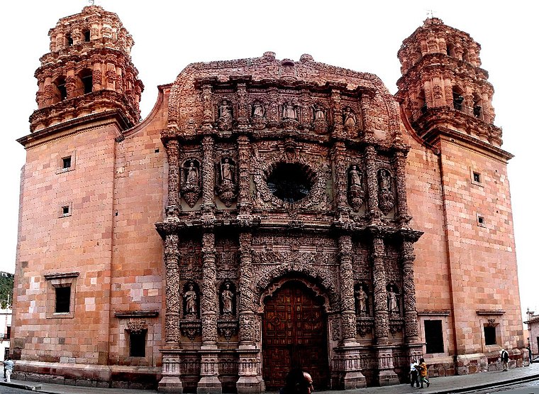
Photo: Jvitela, CC BY-SA 4.0.
The Cathedral of Zacatecas, dedicated to the Virgin of the Assumption, is the main temple of the Diocese of Zacatecas. Located in the historic center of the city, declared World Heritage Site by UNESCO. Cathedral Basilica of Zacatecas is situated 2 km north of PARQUE H. AYUNTAMIENTO.
Acueducto del Cubo

Photo: AndresXXV, Public domain.
Acueducto del Cubo is situated 1½ km northwest of PARQUE H. AYUNTAMIENTO.
Places in the Area
Nearby places include Zacatecas and Guadalupe.
Zacatecas

Photo: GUSTAVIN, CC BY-SA 3.0.
Zacatecas, the capital of the state of the same name, is a city of 138,000 people in the Bajío region of Mexico. The town offers a rich travel experience with its historical downtown centro full of colonial architecture, 17th century churches, innovative restaurants and lively night clubs.
Guadalupe

Photo: AlejandroLinaresGarcia, CC BY-SA 4.0.
Guadalupe is a mid-size city of more than 200,000 inhabitants that is a suburb of Zacatecas in the Bajio region of Mexico. Guadalupe has been designated as one of Mexico's Pueblos Mágicos.
PARQUE H. AYUNTAMIENTO
- Type: Park
- Category: recreation area
- Location: Zacatecas, Bajío, Mexico, North America
- View on OpenStreetMap
Latitude
22.75951° or 22° 45′ 34″ northLongitude
-102.56506° or 102° 33′ 54″ westOpen location code
75JVQC5M+RXOpenStreetMap ID
way 544468146OpenStreetMap feature
leisure=park
This page is based on OpenStreetMap, Wikidata, and Wikimedia Commons.
We’d love your help improving our open data sources. Thank you for contributing.
Satellite Map
Discover PARQUE H. AYUNTAMIENTO from above in high-definition satellite imagery.
Notable Places Nearby
Highlights include Polideportivo Alma Obrera and Parque Marcha Zacatecas.
Nearby Places
Explore places such as Escuela Primaria Alma Obrera and Bandera.
Zacatecas: Must-Visit Destinations
Delve into Zacatecas, Fresnillo, Guadalupe, and Jerez de Garcia Salinas.
Curious Parks to Discover
Uncover intriguing parks from every corner of the globe.
About Mapcarta. Data © OpenStreetMap contributors and available under the Open Database License". Text is available under the CC BY-SA 4.0 license, except for photos, directions, and the map. Photo: Oscarthepatron, CC BY-SA 3.0.