P+R Mont-Blanc
P+R Mont-Blanc is a parking area in Sallanches, Arrondissement of Bonneville, Auvergne-Rhône-Alpes which is located on Avenue de Genève. P+R Mont-Blanc is situated nearby to the lake 3e Lac des Ilettes, as well as near 2e Lac des Ilettes.| Tap on a place to explore it |
- Type: Parking area
- Address: Avenue de Genève, Sallanches, 74700
- Parking: surface
Places of Interest Nearby
Highlights include Cascade de l’Arpenaz and Chapelle-école Saint-François-de-Sales de la Pierre de Sallanches.
Cascade de l’Arpenaz
Waterfall

Photo: Aiguilledumidi, CC BY-SA 4.0.
Cascade de l’Arpenaz is a waterfall, which is situated 2 km northeast of P+R Mont-Blanc.
Chapelle-école Saint-François-de-Sales de la Pierre de Sallanches
Chapel
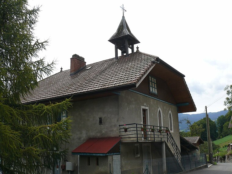
Photo: Peter17, CC BY-SA 4.0.
Chapelle-école Saint-François-de-Sales de la Pierre de Sallanches is situated 2 km southwest of P+R Mont-Blanc.
Sallanches Aerodrome
Sallanches Aerodrome or Sallanches Mont-Blanc Aerodrome, formerly IATA: XSN, ICAO: LFHZ, was an airport in Sallanches, a commune in Haute-Savoie, France. It was permanently closed on 1 September 2020. Sallanches Aerodrome is situated 1½ km southeast of P+R Mont-Blanc.Places in the Area
Nearby places include Sallanches and Oëx.
Sallanches
Town

Photo: Ville de Sallanches, CC BY-SA 4.0.
Sallanches is a commune in the Haute-Savoie department of the Auvergne-Rhône-Alpes region of France. Located close to the Mont Blanc massif, many visitors pass through the town en route to well-known alpine resorts such as Chamonix, Megève and Saint-Gervais-les-Bains. Sallanches is situated 3 km south of P+R Mont-Blanc.
Oëx
Hamlet
Oëx is a village in the Rhône-Alpes region of France, below Pointe d'Areu in the Arve valley. It is part of the commune Magland in Haute-Savoie department. Oëx is situated 3 km north of P+R Mont-Blanc.
Cordon
Village

Photo: ColdEel, CC BY-SA 3.0.
Cordon is a commune in the Haute-Savoie department in the Auvergne-Rhône-Alpes region in south-eastern France. It is part of the urban area of Sallanches. Cordon is situated 4½ km south of P+R Mont-Blanc.
P+R Mont-Blanc
- Category: transportation
- Location: Sallanches, Arrondissement of Bonneville, Haute-Savoie, Auvergne-Rhône-Alpes, France, Europe
- View on OpenStreetMap
Latitude
45.96127° or 45° 57′ 41″ northLongitude
6.63018° or 6° 37′ 49″ eastInception
July 2016Named after
Mont BlancOpen location code
8FQ8XJ6J+G3OpenStreetMap ID
way 544721552OpenStreetMap feature
amenity=parkingOpenStreetMap attribute
parking=surface
This page is based on OpenStreetMap, Wikidata, and Wikimedia Commons.
We’d love your help improving our open data sources. Thank you for contributing.
Satellite Map
Discover P+R Mont-Blanc from above in high-definition satellite imagery.
Notable Places Nearby
Highlights include 3e Lac des Ilettes and Chapelle Saint-Alexis, Saint-Guérin-et-Sainte-Anne de Luzier.
Nearby Places
Explore places such as P+R Mont-Blanc and P+R Mont-Blanc.
Haute-Savoie: Must-Visit Destinations
Delve into Chamonix, Annecy, Annemasse, and Evian.
Curious Parking Areas to Discover
Uncover intriguing parking areas from every corner of the globe.
About Mapcarta. Data © OpenStreetMap contributors and available under the Open Database License". Text is available under the CC BY-SA 4.0 license, except for photos, directions, and the map. Photo: Ypsilon from Finland, CC0.