Parking Saint-Laud 2
Parking Saint-Laud 2 is a parking area in Angers, Maine-et-Loire, Pays de la Loire. Parking Saint-Laud 2 is situated nearby to the church Chapelle de la Fraternité des Capucins d’Angers, as well as near the square Place Giffard Langevin.| Tap on a place to explore it |
- Opening hours: 5:00 AM—midnight
- Type: Parking area
- Parking: multi-storey
Places of Interest Nearby
Highlights include Gare d’Angers-Saint-Laud and Musée des Beaux-Arts d’Angers.
Gare d’Angers-Saint-Laud
Railway station

Photo: Suzelfe, CC BY-SA 3.0.
Angers–Saint-Laud is a railway station located in Angers, Maine-et-Loire, western France. The station was opened in 1849 and is located on the Le Mans–Angers railway and the Tours–Saint-Nazaire railway. Gare d’Angers-Saint-Laud is situated 420 metres east of Parking Saint-Laud 2.
Musée des Beaux-Arts d’Angers
Museum
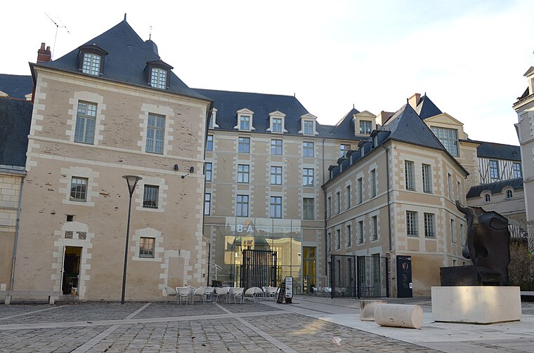
Photo: Selbymay, CC BY-SA 3.0.
The Musée des beaux-arts d'Angers is a museum of art located in a mansion, the "logis Barrault", place Saint-Éloi near the historic city of Angers, western France. Musée des Beaux-Arts d’Angers is situated 760 metres northeast of Parking Saint-Laud 2.
Église Saint-Laud d’Angers
Church

Photo: M.Strīķis, CC BY-SA 3.0.
Église Saint-Laud d’Angers is a church, which is situated 410 metres northeast of Parking Saint-Laud 2.
Places in the Area
Nearby places include Île Saint-Aubin and Avrillé.
Île Saint-Aubin
Locality

Photo: Nono vlf, CC BY-SA 3.0.
Île Saint-Aubin is a locality, which is situated 5 km north of Parking Saint-Laud 2.
Avrillé
Town

Photo: IngolfBLN, CC BY-SA 2.0.
Avrillé is a commune in the Maine-et-Loire department in western France. Avrillé is situated 5 km northwest of Parking Saint-Laud 2.
Saint-Jean-de-Linières
Village

Photo: Pymouss44, CC BY-SA 3.0.
Saint-Jean-de-Linières is a former commune in the Maine-et-Loire department in western France. On 1 January 2019, it was merged into the new commune Saint-Léger-de-Linières. Saint-Jean-de-Linières is situated 7 km west of Parking Saint-Laud 2.
Parking Saint-Laud 2
- Categories: building and transportation
- Location: Angers, Arrondissement of Angers, Maine-et-Loire, Pays de la Loire, France, Europe
- View on OpenStreetMap
Latitude
47.46389° or 47° 27′ 50″ northLongitude
-0.56171° or 0° 33′ 42″ westOpen location code
8CVXFC7Q+H8OpenStreetMap ID
way 547483794OpenStreetMap feature
amenity=parkingOpenStreetMap feature
building=yesOpenStreetMap attribute
parking=multi-storey
This page is based on OpenStreetMap, Wikidata, and Wikimedia Commons.
We’d love your help improving our open data sources. Thank you for contributing.
Satellite Map
Discover Parking Saint-Laud 2 from above in high-definition satellite imagery.
Notable Places Nearby
Highlights include Chapelle de la Fraternité des Capucins d’Angers and Place Giffard Langevin.
Nearby Places
Explore places such as Cesbron and Lagarrigue.
Pays de la Loire: Must-Visit Destinations
Delve into Montsoreau, Nantes, Le Mans, and Saint-Nazaire.
Curious Parking Areas to Discover
Uncover intriguing parking areas from every corner of the globe.
About Mapcarta. Data © OpenStreetMap contributors and available under the Open Database License". Text is available under the CC BY-SA 4.0 license, except for photos, directions, and the map. Photo: Tango7174, CC BY-SA 4.0.