Urb. Doña Rosa
Urb. Doña Rosa is a residential area in Heredia, Central Valley. Urb. Doña Rosa is situated nearby to the community center Salón Comunal, as well as near the post office Centro de Carteros.| Tap on a place to explore it |
Places of Interest Nearby
Highlights include Eladio Rosabal Cordero Stadium and Museo de Cultura Popular.
Eladio Rosabal Cordero Stadium

Photo: Alofaga, CC BY-SA 3.0.
Estadio Eladio Rosabal Cordero was a multi-purpose stadium in Heredia, Costa Rica. The stadium held 8,700 people and opened in 1949. It was mostly used for football matches and was the home stadium of Herediano. Eladio Rosabal Cordero Stadium is situated 1 km southwest of Urb. Doña Rosa.
Museo de Cultura Popular
Museum
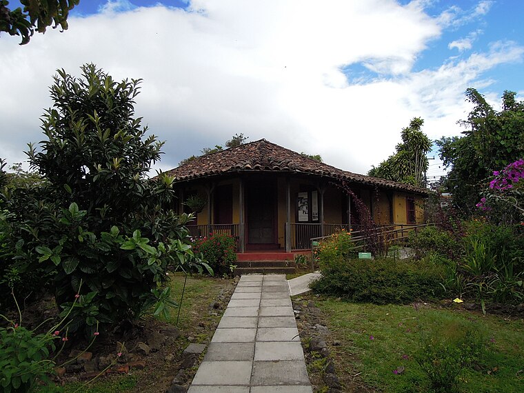
Photo: Rquesada, CC BY-SA 3.0.
Museo de Cultura Popular is a museum in the district of Santa Lucía, just south of Barva, Costa Rica. It is located in the former home of ex-president Alfredo González Flores. Museo de Cultura Popular is situated 1¼ km northeast of Urb. Doña Rosa.
Parroquia San Bartolomé Apóstol
Church

Photo: Tillor87, CC BY-SA 3.0.
The Parroquia San Bartolomé Apóstol, is a church in Barva, Heredia, Costa Rica. The first church was established between 1568 and 1575, and dedicated to Saint Bartholomew; it is rumored to have been built on an indigenous burial ground. Parroquia San Bartolomé Apóstol is situated 1½ km north of Urb. Doña Rosa.
Places in the Area
Nearby places include Barva and Santa Bárbara de Heredia.
Barva
Town
Photo: Tillor87, CC BY-SA 3.0.
Barva is a district of the Barva canton, in the Heredia province of Costa Rica. The city is known for having a nice mix of rural and metropolitan landscape.
Santa Bárbara de Heredia
Town

Photo: Victor Quirós A, CC BY-SA 3.0.
Santa Bárbara is one of the six districts that make up the canton of Santa Bárbara, Costa Rica. The district of Santa Bárbara is commonly referred to as Santa Bárbara de Heredia, and is the seat of the municipality of Santa Bárbara, and therefore awarded the title of city. Santa Bárbara de Heredia is situated 5 km northwest of Urb. Doña Rosa.
San José de la Montaña District
Village

Photo: Victor Quirós A, CC BY-SA 3.0.
San José de la Montaña is a district of the Barva canton, in the Heredia province of Costa Rica. San José de la Montaña District is situated 6 km north of Urb. Doña Rosa.
Urb. Doña Rosa
Latitude
10.00666° or 10° 0′ 24″ northLongitude
-84.11981° or 84° 7′ 11″ westOpen location code
762Q2V4J+M3OpenStreetMap ID
way 547783410OpenStreetMap feature
landuse=residential
This page is based on OpenStreetMap, Wikidata, and Wikimedia Commons.
We’d love your help improving our open data sources. Thank you for contributing.
Satellite Map
Discover Urb. Doña Rosa from above in high-definition satellite imagery.
Places with the Same Name
Discover other places named “Urb. Doña Rosa”.
Notable Places Nearby
Highlights include Salón Comunal and Centro de Carteros.
Nearby Places
Explore places such as Vidrios Alugla and Jardín de Niños Fátima.
Central Valley: Must-Visit Destinations
Delve into San José, Alajuela, Turrialba, and San Ramon.
Curious Residential Areas to Discover
Uncover intriguing residential areas from every corner of the globe.
About Mapcarta. Data © OpenStreetMap contributors and available under the Open Database License". Text is available under the CC BY-SA 4.0 license, except for photos, directions, and the map. Photo: Rquesada, CC BY-SA 3.0.