Lago dos Patos
Lago dos Patos is a lake in Póvoa de Santa Iria e Forte da Casa, Vila Franca de Xira, Lisbon District. Lago dos Patos is situated nearby to the hamlet Bragadas, as well as near the neighborhood Urbanização Quinta da Gaia.| Tap on a place to explore it |
Places of Interest
Highlights include Fort of Casa and Quinta de Nossa Senhora da Piedade.
Fort of Casa
Protected area

Photo: Roundtheworld, CC BY-SA 4.0.
The Fort of Casa was the most easterly of the forts and redoubts built in 1809-10 during the Peninsular War on the second line of the three defensive Lines of Torres Vedras aimed at protecting the capital of Portugal, Lisbon.
Quinta de Nossa Senhora da Piedade
Park

Photo: Tom Strong, CC BY-SA 3.0.
Quinta de Nossa Senhora da Piedade is a park.
Castle of Pirescoxe
Castle
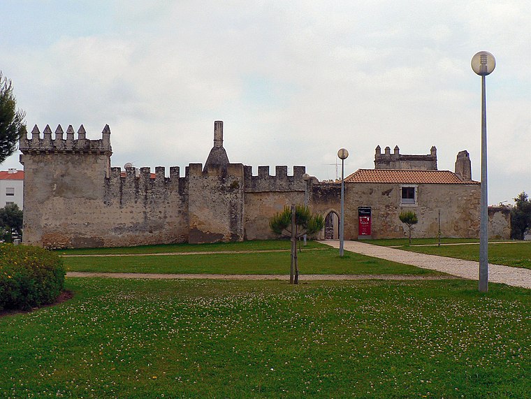
Photo: Juntas, CC BY-SA 2.5.
The Castle of Pirescoxe is a castle located in Santa Iria de Azoia, in the municipality of Loures, Portugal. It is classified by IGESPAR as a site of public interest.
Places in the Area
Nearby places include Santa Iria de Azoia and Vialonga.
Santa Iria de Azoia
Town

Photo: Juntas, CC BY-SA 3.0.
Santa Iria de Azoia is a town and former freguesia in the municipality of Loures, Portugal. Since 2013, it is part of the freguesia Santa Iria de Azoia, São João da Talha e Bobadela. Its population in 2011 was 18,240.
Vialonga
Town

Photo: Vitor Oliveira, CC BY-SA 2.0.
Vialonga is a town and freguesia in the municipality of Vila Franca de Xira, Portugal. Its population in 2021 was 21,261.
Bucelas
Town

Photo: Juntas, CC BY-SA 3.0.
Bucelas is a civil parish in the municipality of Loures, Portugal. The population in 2011 was 4,663, in an area of 33.97 km². The town is known for its Bucelas DOC wine.
Lago dos Patos
- Type: Lake
- Category: body of water
- Location: Póvoa de Santa Iria e Forte da Casa, Vila Franca de Xira, Lisbon District, Portugal, Iberia, Europe
- View on OpenStreetMap
Latitude
38.862° or 38° 51′ 43″ northLongitude
-9.0702° or 9° 4′ 13″ westOpen location code
8CCGVW6H+QWOpenStreetMap ID
way 552169155OpenStreetMap feature
natural=waterOpenStreetMap feature
water=lake
This page is based on OpenStreetMap, Wikidata, and Wikimedia Commons.
We’d love your help improving our open data sources. Thank you for contributing.
Satellite Map
Discover Lago dos Patos from above in high-definition satellite imagery.
Places with the Same Name
Discover other places named “Lago dos Patos”.
Localities in the Area
Explore places such as Bragadas and Urbanização Quinta da Gaia.
Notable Places Nearby
Highlights include Parque dos Animais and Palácio da Quinta de Nossa Senhora da Piedade.
Portugal: Must-Visit Destinations
Delve into Lisbon, Caldas da Rainha, Porto, and Coimbra.
Curious Lakes to Discover
Uncover intriguing lakes from every corner of the globe.
About Mapcarta. Data © OpenStreetMap contributors and available under the Open Database License". Text is available under the CC BY-SA 4.0 license, except for photos, directions, and the map. Photo: Tobias Scheck, CC BY 2.0.