Hoesch - Schwerter Profile
Hoesch - Schwerter Profile is an industrial building in Schwerte, Unna, North Rhine-Westphalia. Hoesch - Schwerter Profile is situated nearby to the mosque Süleymaniye Moschee, as well as near the sports venue Sporthalle.| Tap on a place to explore it |
Places of Interest Nearby
Highlights include Schwerte station and Ruhrtalmuseum.
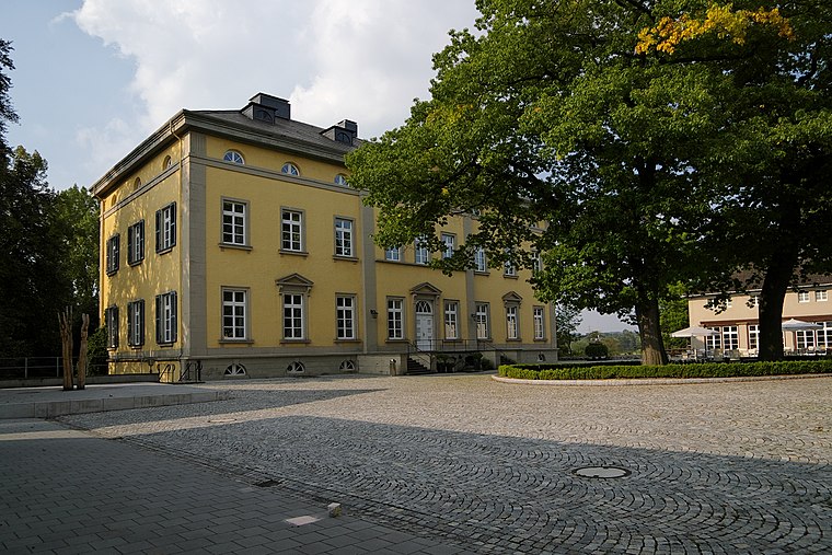
Schwerte station
Railway station

Photo: Helfmann, CC BY-SA 3.0.
Schwerte station is a through station in the town of Schwerte in the German state of North Rhine-Westphalia. The station was opened with the section of the Hagen–Hamm railway between Hagen and Holzwickede, opened by the Bergisch-Märkische Railway Company on 1 April 1867. Schwerte station is situated 380 metres north of Hoesch - Schwerter Profile.
Ruhrtalmuseum
Museum

Photo: Wikimedia, Public domain.
Ruhrtalmuseum is situated 800 metres east of Hoesch - Schwerter Profile.
Marienkrankenhaus Schwerte
Hospital

Photo: Kogge, CC BY-SA 3.0.
Marienkrankenhaus Schwerte is a hospital, which is situated 1 km northeast of Hoesch - Schwerter Profile.
Places in the Area
Nearby places include Villigst and Westhofen.
Villigst
Suburb
 Villigst is a Stadtteil of the city Schwerte in North Rhine-Westphalia, Germany. On 31 December 2012, Villigst had a population of 3.309 inhabitants. It lies south of the river Ruhr near Sauerland.

Ergste
Suburb
Ergste is a stadtbezirk of the town of Schwerte in Germany. As of 31 December 2012, Ergste had a population of 7025 inhabitants. It lies south of the river Ruhr near Sauerland. Ergste is situated 2½ km south of Hoesch - Schwerter Profile.
Hoesch - Schwerter Profile
- Type: Industrial building
- Categories: building and industry
- Location: Schwerte, Unna, Arnsberg, North Rhine-Westphalia, Germany, Central Europe, Europe
- View on OpenStreetMap
Latitude
51.4388° or 51° 26′ 20″ northLongitude
7.55872° or 7° 33′ 31″ eastOpen location code
9F39CHQ5+GFOpenStreetMap ID
way 55263229OpenStreetMap feature
building=industrial
This page is based on OpenStreetMap, Wikidata, and Wikimedia Commons.
We’d love your help improving our open data sources. Thank you for contributing.
Satellite Map
Discover Hoesch - Schwerter Profile from above in high-definition satellite imagery.
Notable Places Nearby
Highlights include Süleymaniye Moschee and Sporthalle.
Nearby Places
Explore places such as ALDI Nord and Factory 4.
North Rhine-Westphalia: Must-Visit Destinations
Delve into Cologne, Düsseldorf, Bonn, and Dortmund.
Curious Industrial Buildings to Discover
Uncover intriguing industrial buildings from every corner of the globe.
About Mapcarta. Data © OpenStreetMap contributors and available under the Open Database License". Text is available under the CC BY-SA 4.0 license, except for photos, directions, and the map. Photo: Daniel Schwen, CC BY-SA 2.5.