Picnic Area 2
Picnic Area 2 is a picnic site in City and County of Denver, Colorado. Picnic Area 2 is situated nearby to the pitch Softball SB1, as well as near Mixed Use MU4.| Tap on a place to explore it |
Places of Interest Nearby
Highlights include Ball Arena and Elitch Theatre.
Ball Arena
Stadium
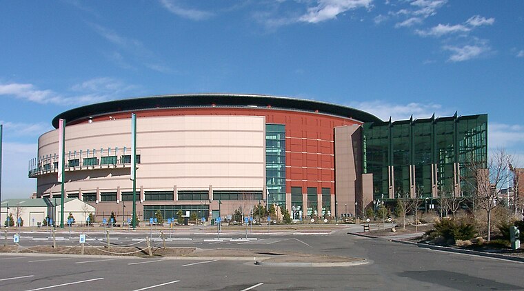
Photo: Wikimedia, CC BY-SA 2.5.
Ball Arena is a multi-purpose indoor arena located in Denver, Colorado, United States. It is situated at Speer Boulevard, a main thoroughfare in downtown Denver, and is served by two nearby exits off Interstate 25. Ball Arena is situated 2 miles east of Picnic Area 2.
Elitch Theatre
Theater building

Photo: Hustvedt, CC BY-SA 3.0.
The Historic Elitch Theatre is located at the original Elitch Gardens site in northwest Denver, Colorado. Opened in 1890, it was centerpiece of the park that was the first zoo west of Chicago. Elitch Theatre is situated 1 mile north of Picnic Area 2.
Downtown Aquarium
Public aquarium

Photo: Ginkgo100, CC BY-SA 3.0.
Downtown Aquarium is a for profit aquarium and restaurant located in Denver, Colorado, at the intersection of I-25 and 23rd Ave. The 107,000 square feet main building sits on a 17-acre site adjacent to the South Platte River. Downtown Aquarium is situated 1½ miles east of Picnic Area 2.
Places in the Area
Nearby places include West Colfax and Edgewater.
West Colfax
Neighborhood

Photo: Denverjeffrey, CC BY 3.0.
West Colfax is a neighborhood of Denver, Colorado. The neighborhood is located in the West Denver area. In 2015 the population of the neighborhood was 9,120, and there were 4,055 housing units.
Edgewater
Town

Photo: Denverjeffrey, CC BY 3.0.
The City of Edgewater is a home rule municipality located in Jefferson County, Colorado, United States. The city population was 5,005 at the 2020 United States census.
Jefferson Park
Neighborhood

Photo: Denverjeffrey, CC BY 3.0.
Jefferson Park is a neighborhood and public park that overlooks Downtown Denver, Colorado from its perch across Interstate 25. It is located in the area that is called North Denver.
Picnic Area 2
- Type: Picnic site
- Category: tourism
- Location: City and County of Denver, Colorado, Rocky Mountains, United States, North America
- View on OpenStreetMap
Latitude
39.75381° or 39° 45′ 14″ northLongitude
-105.04435° or 105° 2′ 40″ westOpen location code
85FPQX34+G7OpenStreetMap ID
way 553469684OpenStreetMap feature
tourism=picnic_site
This page is based on OpenStreetMap, Wikidata, and Wikimedia Commons.
We’d love your help improving our open data sources. Thank you for contributing.
Satellite Map
Discover Picnic Area 2 from above in high-definition satellite imagery.
Places with the Same Name
Discover other places named “Picnic Area 2”.
Notable Places Nearby
Highlights include Softball SB1 and Mixed Use MU4.
Nearby Places
Explore places such as ‘Lake Totem’ Pelican and 26th and Vrain.
Colorado: Must-Visit Destinations
Delve into Denver, Colorado Springs, Boulder, and Aurora.
Curious Picnic Sites to Discover
Uncover intriguing picnic sites from every corner of the globe.
About Mapcarta. Data © OpenStreetMap contributors and available under the Open Database License". Text is available under the CC BY-SA 4.0 license, except for photos, directions, and the map. Photo: mark gallagher, CC BY 2.0.