Sing- und Musizierplatz
Sing- und Musizierplatz is a grassland in North Rhine-Westphalia, Germany. Sing- und Musizierplatz is situated nearby to the lake Borner See, as well as near the playground Born hinter Kirche.| Tap on a place to explore it |
Places of Interest Nearby
Highlights include Borner See and Saint Peter Church.

Saint Peter Church
Church
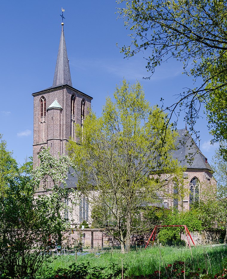
Photo: Tuxyso, CC BY-SA 3.0.
Saint Peter Church is situated 260 metres northwest of Sing- und Musizierplatz.
Borner Mühle

Photo: Tuxyso, CC BY-SA 3.0.
Borner Mühle is situated 730 metres west of Sing- und Musizierplatz.
Places in the Area
Nearby places include Brüggen and Brempt.
Brüggen
Town

Photo: Wikimedia, CC BY-SA 3.0.
Brüggen is a municipality in the district of Viersen, in North Rhine-Westphalia, Germany. It is situated near the border with the Netherlands, on the river Schwalm, approx. 15 km south of Venlo, 11 km east of Swalmen and 20 km north-west of Mönchengladbach.
Brempt
Village

Photo: Wikimedia, Public domain.
Brempt is a village, which is situated 3 km south of Sing- und Musizierplatz.
Niederkrüchten
Town

Photo: Ichmichi, CC BY-SA 3.0.
Niederkrüchten is a municipality in the district of Viersen, in North Rhine-Westphalia, Germany. It is situated approximately 15 km east of Roermond in the Netherlands and 15 km west of Mönchengladbach. Niederkrüchten is situated 4½ km south of Sing- und Musizierplatz.
Sing- und Musizierplatz
- Type: Grassland
- Location: North Rhine-Westphalia, Germany, Central Europe, Europe
- View on OpenStreetMap
Latitude
51.24101° or 51° 14′ 28″ northLongitude
6.2145° or 6° 12′ 52″ eastOpen location code
9F3866R7+CQOpenStreetMap ID
way 566143857OpenStreetMap feature
landuse=grass
This page is based on OpenStreetMap, Wikidata, and Wikimedia Commons.
We’d love your help improving our open data sources. Thank you for contributing.
Satellite Map
Discover Sing- und Musizierplatz from above in high-definition satellite imagery.
Notable Places Nearby
Highlights include Wasser.Blick 16 - Borner See and Born hinter Kirche.
Nearby Places
Explore places such as Öffentlicher Bouleplatz and Pfarramt St. Peter.
North Rhine-Westphalia: Must-Visit Destinations
Delve into Cologne, Düsseldorf, Bonn, and Dortmund.
Curious Grasslands to Discover
Uncover intriguing grasslands from every corner of the globe.
About Mapcarta. Data © OpenStreetMap contributors and available under the Open Database License". Text is available under the CC BY-SA 4.0 license, except for photos, directions, and the map. Photo: Daniel Schwen, CC BY-SA 2.5.