Kläranlage Vellberg
Kläranlage Vellberg is a wastewater treatment plant in Vellberg, Schwäbisch Hall, Baden-Württemberg. Kläranlage Vellberg is situated nearby to the cemetery Friedhof Vellberg, as well as near the church St. Martin (Stöckenburg).| Tap on a place to explore it |
Places of Interest Nearby
Highlights include St. Martin (Stöckenburg) and Unteres Schloss.
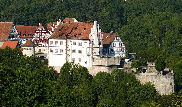
St. Martin (Stöckenburg)
Church

Photo: RIrmler, CC BY-SA 3.0 de.
St. Martin (Stöckenburg) is a church, which is situated 300 metres southeast of Kläranlage Vellberg.
Unteres Schloss
Castle
 Unteres Schloss is a castle, which is situated 520 metres southeast of Kläranlage Vellberg.
Oberes Schloss
Public building

Photo: Michael Barera, CC BY-SA 3.0.
Oberes Schloss is a public building, which is situated 490 metres southeast of Kläranlage Vellberg.
Places in the Area
Nearby places include Anhausen and Merkelbach.

Schneckenweiler
Hamlet

Photo: BerndH, CC BY-SA 3.0.
Schneckenweiler is a hamlet, which is situated 2½ km east of Kläranlage Vellberg.
Kläranlage Vellberg
- Type: Wastewater treatment plant
- Category: industry
- Location: Vellberg, Schwäbisch Hall, Stuttgart, Baden-Württemberg, Germany, Central Europe, Europe
- View on OpenStreetMap
Latitude
49.09145° or 49° 5′ 29″ northLongitude
9.87877° or 9° 52′ 44″ eastOpen location code
8FXF3VRH+HGOpenStreetMap ID
way 568379168OpenStreetMap feature
man_made=wastewater_plant
This page is based on OpenStreetMap, Wikidata, and Wikimedia Commons.
We’d love your help improving our open data sources. Thank you for contributing.
Satellite Map
Discover Kläranlage Vellberg from above in high-definition satellite imagery.
Notable Places Nearby
Highlights include Friedhof Vellberg and Stadthalle Vellberg.
Nearby Places
Explore places such as Aussegnungshalle and Evangelisches Pfarramt Stöckenburg.
Baden-Württemberg: Must-Visit Destinations
Delve into Stuttgart, Heidelberg, Karlsruhe, and Mannheim.
Curious Wastewater Treatment Plants to Discover
Uncover intriguing wastewater treatment plants from every corner of the globe.
About Mapcarta. Data © OpenStreetMap contributors and available under the Open Database License". Text is available under the CC BY-SA 4.0 license, except for photos, directions, and the map. Photo: Traveler100, CC BY-SA 3.0.