Tree of Life Missionary Baptist Church
Tree of Life Missionary Baptist Church is a church in Greenville County, South Carolina which is located on Mcalister Road. Tree of Life Missionary Baptist Church is situated nearby to Second Calvary Missionary Baptist Church, as well as near Zion Hill Baptist Church.| Tap on a place to explore it |
- Type: Church
- Denomination: Baptist
- Address: 400 Mcalister Road, Greenville, SC 29607
Places of Interest Nearby
Highlights include Greenville Technical Charter High School and McAlister Square.
Greenville Technical Charter High School
College building
Greenville Technical Charter High School is a small school located on the Barton Campus of Greenville Technical College in Greenville, South Carolina, United States. Greenville Technical Charter High School is situated 2,900 feet southwest of Tree of Life Missionary Baptist Church.
McAlister Square
Commercial area

Photo: Mike Kalasnik, CC BY-SA 2.0.
McAlister Square is an American repositioned shopping mall in Greenville, South Carolina. It is notable for being the first enclosed shopping center in South Carolina, and the largest shopping center in the state at the time it was built. McAlister Square is situated 3,000 feet northeast of Tree of Life Missionary Baptist Church.
Lanneau-Norwood House
Building

Photo: Jack Boucher, Public domain.
The Lanneau-Norwood House is a historic, late 19th-century house on Belmont Avenue in Greenville, South Carolina. The house is an outstanding example of Second Empire architecture in the American South and is one of the last surviving Victorian-era homes in Greenville. Lanneau-Norwood House is situated 1¼ miles west of Tree of Life Missionary Baptist Church.
Places in the Area
Nearby places include Nicholtown and Pettigru Street Historic District.
Nicholtown
Hamlet
Nicholtown is a predominantly African-American community in Greenville, South Carolina. Jacqueline Woodson's award-winning adolescent novel, Brown Girl Dreaming was based on recollections of her childhood in Nicholtown.
Pettigru Street Historic District
Neighborhood
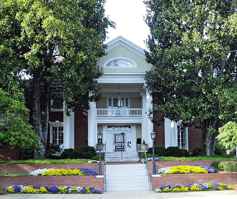
Photo: Bigskybill, CC BY-SA 3.0.
Pettigru Street Historic District is a historic tree-lined neighborhood east of Main Street in downtown Greenville, South Carolina. It is home to 88 structures built between 1890 and 1930 with the majority built between 1910 and 1930. Pettigru Street Historic District is situated 1½ miles northwest of Tree of Life Missionary Baptist Church.
Overbrook
Hamlet
Overbrook is a neighborhood in Greenville, South Carolina. It is a neighborhood built in 1913 upon expansion of the trolley line that was extended into the area three years earlier. Overbrook is situated 2 miles north of Tree of Life Missionary Baptist Church.
Tree of Life Missionary Baptist Church
- Categories: building, place of worship, and religion
- Location: Greenville County, South Carolina, South, United States, North America
- View on OpenStreetMap
Latitude
34.83332° or 34° 50′ northLongitude
-82.37086° or 82° 22′ 15″ westHeight
46 feet (14 metres)Open location code
866VRJMH+8MOpenStreetMap ID
way 571419897OpenStreetMap feature
amenity=place_of_worshipOpenStreetMap feature
building=churchOpenStreetMap attribute
denomination=baptist
This page is based on OpenStreetMap, Wikidata, and Wikimedia Commons.
We’d love your help improving our open data sources. Thank you for contributing.
Satellite Map
Discover Tree of Life Missionary Baptist Church from above in high-definition satellite imagery.
Places with the Same Name
Discover other places named “Tree of Life Missionary Baptist Church”.
Notable Places Nearby
Highlights include Second Calvary Missionary Baptist Church and Zion Hill Baptist Church.
Nearby Places
Explore places such as Glenn Rd @ McAlister Road and Borderlands Comics and Games.
South Carolina: Must-Visit Destinations
Delve into Columbia, Charleston, Greenville, and Myrtle Beach.
Curious Churches to Discover
Uncover intriguing churches from every corner of the globe.
About Mapcarta. Data © OpenStreetMap contributors and available under the Open Database License". Text is available under the CC BY-SA 4.0 license, except for photos, directions, and the map. Photo: Rastapopulous, CC BY-SA 3.0.