Kläranlage Sulzdorf
Kläranlage Sulzdorf is a wastewater treatment plant in Schwäbisch Hall, Stuttgart, Baden-Württemberg. Kläranlage Sulzdorf is situated nearby to the fire station Feuerwehr Schwäbisch Hall, Abteilung Sulzdorf, as well as near the playground Kresswiesen-Spielplatz.| Tap on a place to explore it |
Places of Interest Nearby
Highlights include Unteres Schloss and Oberes Schloss.
Unteres Schloss
Castle
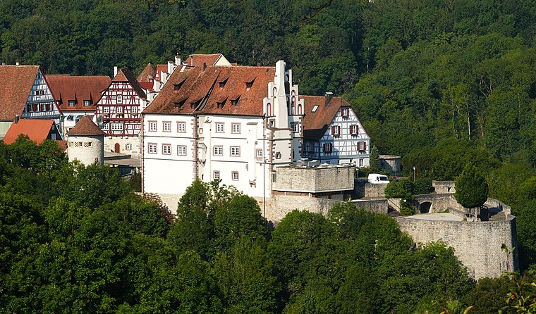 Unteres Schloss is a castle, which is situated 3 km southeast of Kläranlage Sulzdorf.
Oberes Schloss
Public building

Photo: Michael Barera, CC BY-SA 3.0.
Oberes Schloss is a public building, which is situated 3 km southeast of Kläranlage Sulzdorf.
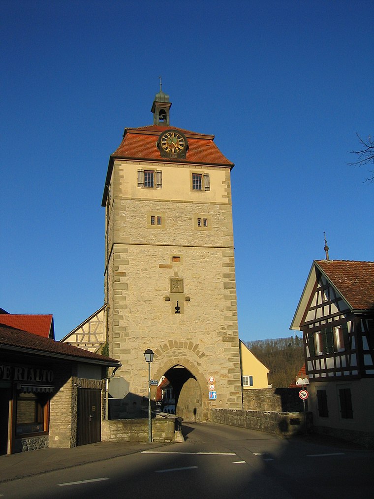
Altes Amtshaus
Public building
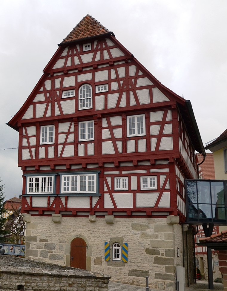
Photo: Tilman2007, CC BY-SA 3.0.
Altes Amtshaus is a public building, which is situated 3 km southeast of Kläranlage Sulzdorf.
Places in the Area
Nearby places include Anhausen and Vellberg.

Vellberg
Town
 Vellberg is a town in the district of Schwäbisch Hall, in Baden-Württemberg, Germany. It is located 10 km east of Schwäbisch Hall, and 15 km southwest of Crailsheim. Vellberg is situated 3 km southeast of Kläranlage Sulzdorf.
Unterscheffach
Hamlet
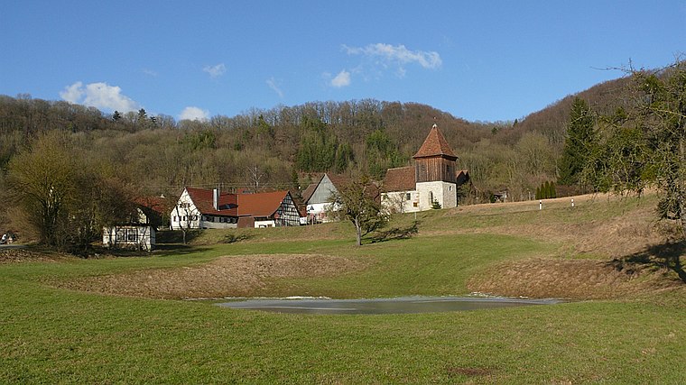
Photo: BerndH, CC BY-SA 3.0.
Unterscheffach is a hamlet, which is situated 4½ km north of Kläranlage Sulzdorf.
Kläranlage Sulzdorf
- Type: Wastewater treatment plant
- Category: industry
- Location: Schwäbisch Hall, Schwäbisch Hall, Stuttgart, Rhine-Neckar, Baden-Württemberg, Germany, Central Europe, Europe
- View on OpenStreetMap
Latitude
49.10223° or 49° 6′ 8″ northLongitude
9.85053° or 9° 51′ 2″ eastOpen location code
8FXF4V22+V6OpenStreetMap ID
way 574606730OpenStreetMap feature
man_made=wastewater_plant
This page is based on OpenStreetMap, Wikidata, and Wikimedia Commons.
We’d love your help improving our open data sources. Thank you for contributing.
Satellite Map
Discover Kläranlage Sulzdorf from above in high-definition satellite imagery.
Notable Places Nearby
Highlights include Feuerwehr Schwäbisch Hall, Abteilung Sulzdorf and Kresswiesen-Spielplatz.
Nearby Places
Explore places such as Tierkörperbeseitigung Neckar-Franken and Gartenäcker.
Rhine-Neckar: Must-Visit Destinations
Delve into Heidelberg, Karlsruhe, Mannheim, and Heilbronn.
Curious Wastewater Treatment Plants to Discover
Uncover intriguing wastewater treatment plants from every corner of the globe.
About Mapcarta. Data © OpenStreetMap contributors and available under the Open Database License". Text is available under the CC BY-SA 4.0 license, except for photos, directions, and the map. Photo: marsupium photography, CC BY-SA 2.0.