Vogl Deckensysteme GmbH
Vogl Deckensysteme GmbH is an industrial building in Emskirchen, Neustadt-Bad Windsheim, Bavaria which is located on Anton Vogl Straße. Vogl Deckensysteme GmbH is situated nearby to the hamlet Riedelhof, as well as near the coniferous forest Winterleiten.| Tap on a place to explore it |
Places of Interest Nearby
Highlights include Emskirchen and St. Georg.
Emskirchen
Railway station
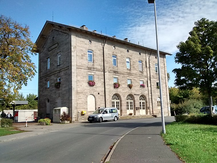
Photo: WMguegafue, CC BY-SA 4.0.
Emskirchen is a railway station, which is situated 1½ km east of Vogl Deckensysteme GmbH.
St. Georg
Church

Photo: Tilman2007, CC BY 3.0.
St. Georg is a church, which is situated 2 km northeast of Vogl Deckensysteme GmbH.
Auferstehungskirche
Church

Photo: Tilman2007, CC BY 3.0.
Auferstehungskirche is a church, which is situated 2 km southeast of Vogl Deckensysteme GmbH.
Places in the Area
Nearby places include Riedelhof and Flugshof.


Neuschauerberg
Village
 Neuschauerberg is a village, which is situated 2½ km south of Vogl Deckensysteme GmbH.
Vogl Deckensysteme GmbH
- Type: Industrial building
- Address: Anton Vogl Straße 1, Emskirchen, 91448
- Categories: building and industry
- Location: Emskirchen, Neustadt-Bad Windsheim, Middle Franconia, Franconia, Bavaria, Germany, Central Europe, Europe
- View on OpenStreetMap
Latitude
49.55968° or 49° 33′ 35″ northLongitude
10.69007° or 10° 41′ 24″ eastOpen location code
8FXGHM5R+V2OpenStreetMap ID
way 579391471OpenStreetMap feature
building=industrial
This page is based on OpenStreetMap, Wikidata, and Wikimedia Commons.
We’d love your help improving our open data sources. Thank you for contributing.
Satellite Map
Discover Vogl Deckensysteme GmbH from above in high-definition satellite imagery.
Notable Places Nearby
Highlights include Winterleiten and Dreifach-Turnhalle.
Nearby Places
Explore places such as Vogl - Kompetenzzentrum and Emskirchen West.
Middle Franconia: Must-Visit Destinations
Delve into Nuremberg, Erlangen, Fürth, and Ansbach.
Curious Industrial Buildings to Discover
Uncover intriguing industrial buildings from every corner of the globe.
About Mapcarta. Data © OpenStreetMap contributors and available under the Open Database License". Text is available under the CC BY-SA 4.0 license, except for photos, directions, and the map. Photo: Berthold Werner, CC0.