Jardines de la iglesia San José
Jardines de la iglesia San José is a park in El Valle, Antón District, Coclé Province. Jardines de la iglesia San José is situated nearby to the museum Museo Padre José Noto, as well as near the park Plaza Iglesia de San José.| Tap on a place to explore it |
Places of Interest Nearby
Highlights include El Valle and Cerro Gaital.
El Valle
Volcano
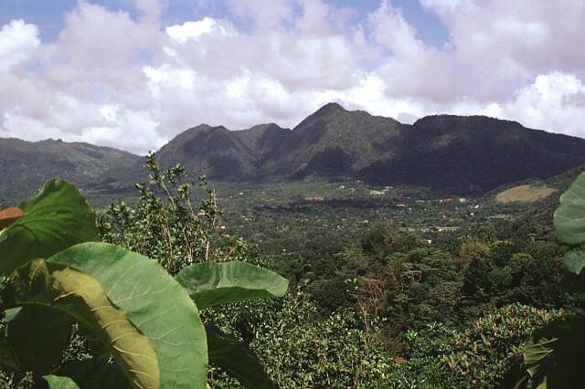
Photo: Wikimedia, Public domain.
El Valle is a stratovolcano in central Panama and is the easternmost volcano along the Central American Volcanic Arc which has been formed by the subduction of the Nazca Plate below Central America.
Cerro Gaital
Peak

Photo: Kiam-shim, CC BY-SA 3.0.
Cerro Gaital is a peak, which is situated 2½ km northeast of Jardines de la iglesia San José.
Places in the Area
Nearby places include Alto de la Estancia.
Alto de la Estancia
Village
Alto de la Estancia is a town in the Coclé province of Panama. Alto de la Estancia is situated 4½ km west of Jardines de la iglesia San José.
Jardines de la iglesia San José
- Type: Park
- Category: recreation area
- Location: El Valle, Antón District, Coclé Province, Central Panama, Panama, Central America, North America
- View on OpenStreetMap
Latitude
8.60535° or 8° 36′ 19″ northLongitude
-80.13498° or 80° 8′ 6″ westOpen location code
66WXJV48+42OpenStreetMap ID
way 581617087OpenStreetMap feature
leisure=park
This page is based on OpenStreetMap, Wikidata, and Wikimedia Commons.
We’d love your help improving our open data sources. Thank you for contributing.
Satellite Map
Discover Jardines de la iglesia San José from above in high-definition satellite imagery.
Notable Places Nearby
Highlights include Iglesia San José and Museo Padre José Noto.
Nearby Places
Explore places such as Gaital and Carlitos.
Central Panama: Must-Visit Destinations
Delve into Panama City, Colon, Portobelo, and Tocumen International Airport.
Curious Parks to Discover
Uncover intriguing parks from every corner of the globe.
About Mapcarta. Data © OpenStreetMap contributors and available under the Open Database License". Text is available under the CC BY-SA 4.0 license, except for photos, directions, and the map. Photo: Robvann, CC BY-SA 4.0.