Spillehulen
Spillehulen is a board games shop in Odense Municipality, Region of Southern Denmark. Spillehulen is situated nearby to the village Holmstrup, as well as near Bellinge.| Tap on a place to explore it |
Places of Interest Nearby
Highlights include Sanderum Church and Brændekilde Church.
Sanderum Church
Church
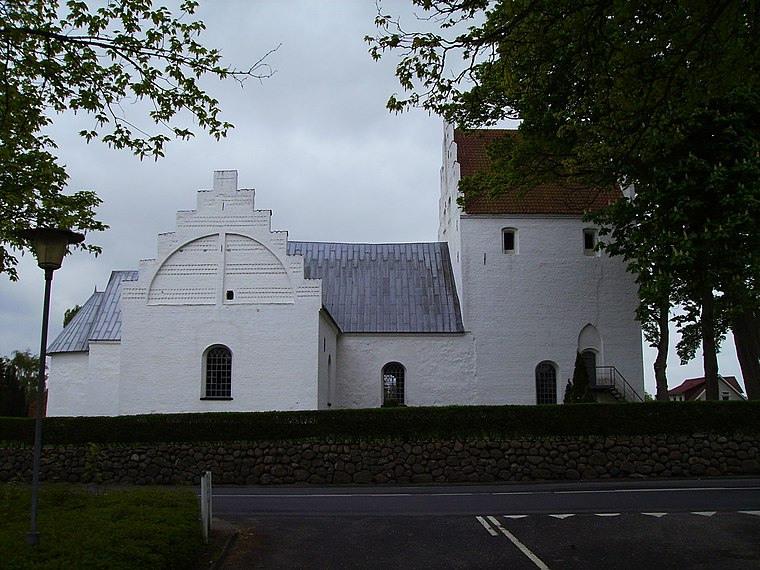
Photo: ScM, CC BY-SA 3.0.
Sanderum Church is situated 2 km northeast of Spillehulen.
Brændekilde Church
Church

Photo: ScM, CC BY-SA 3.0.
Brændekilde Church is situated 2 km west of Spillehulen.
Rasmus Rask-Skolen
School

Photo: Beethoven9, CC BY-SA 4.0.
Rasmus Rask-Skolen is a school, which is situated 1½ km southwest of Spillehulen.
Places in the Area
Nearby places include Holmstrup and Bellinge.
Holmstrup
Village
Holmstrup is a village, with a population of 222, to the southwest of Odense, in Funen, Denmark.
Bellinge
Village

Photo: ScM, CC BY-SA 3.0.
Bellinge is a village and parish in Denmark. It is situated southwest of Odense, and is a suburb of the city. As of 1 January 2025 the village has a population of 5,877. It is known for its church, Bellinge Kirke, with murals dating from 1496.
Dyrup
Suburb
Dyrup is a community and suburb of Odense, Denmark, along the green Odense River valley. Before the 1950s, Dyrup had approximately 700 inhabitants, was mostly rural and part of Sanderum municipality and parish. Dyrup is situated 2½ km east of Spillehulen.
Spillehulen
- Email: info@spillehulen.dk
- Type: Board games shop
- Categories: building and shop
- Location: Odense Municipality, Region of Southern Denmark, Denmark, Nordic countries, Europe
- View on OpenStreetMap
Latitude
55.35671° or 55° 21′ 24″ northLongitude
10.30675° or 10° 18′ 24″ eastOpen location code
9F7G9844+MMOpenStreetMap ID
way 582898770OpenStreetMap feature
building=yesOpenStreetMap feature
shop=games
This page is based on OpenStreetMap, Wikidata, and Wikimedia Commons.
We’d love your help improving our open data sources. Thank you for contributing.
Satellite Map
Discover Spillehulen from above in high-definition satellite imagery.
Notable Places Nearby
Highlights include Sanderum Boldklub and Sanderum Rideklub.
Nearby Places
Explore places such as 150 kV Odense Vest and 60 kV Odense Vest.
Denmark: Must-Visit Destinations
Delve into Copenhagen, Aarhus, Odense, and Aalborg.
Curious Board Games Shops to Discover
Uncover intriguing board games shops from every corner of the globe.
About Mapcarta. Data © OpenStreetMap contributors and available under the Open Database License". Text is available under the CC BY-SA 4.0 license, except for photos, directions, and the map. Photo: Wikimedia, CC0.