The Dunwynn Centre
The Dunwynn Centre is a retail building in Peel, Greater Toronto Area, Ontario which is located on Dundas Street East. The Dunwynn Centre is situated nearby to the sports venue The Forge, as well as near Fuzion Fitness.| Tap on a place to explore it |
Places of Interest Nearby
Highlights include Dixie GO Station and Sherway Gardens.
Dixie GO Station
Railway station

Photo: Secondarywaltz, CC BY-SA 3.0.
Dixie GO Station is a GO Transit railway station on the Milton line in the Dixie neighbourhood of Mississauga, Ontario, Canada. It is located at 2445 Dixie Road, just south of Dundas Street East. Dixie GO Station is situated 620 metres south of The Dunwynn Centre.
Sherway Gardens
Shopping center
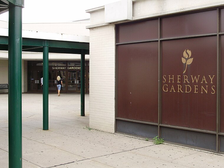
Photo: GTD Aquitaine, Public domain.
Sherway Gardens is a shopping mall in the Etobicoke district of Toronto, Ontario, Canada, near the interchange of Highway 427 with Queen Elizabeth Way and the Gardiner Expressway. Sherway Gardens is situated 1½ km east of The Dunwynn Centre.
ISNA Canada
School
ISNA Canada is a non-profit Muslim religious organization in Canada. It offers a variety of programs and services to the Canadian Muslim community at large, and is associated with the Islamic Society of North America, which is based in the United States. ISNA Canada is situated 1¼ km southeast of The Dunwynn Centre.
Places in the Area
Nearby places include Dixie and Markland Wood.
Dixie
Neighborhood

Photo: GTD Aquitaine, Public domain.
Dixie is a neighbourhood in the city of Mississauga, Ontario, Canada. The community lies in the southeastern part of the city and is one of the older neighbourhoods in the city.
Markland Wood
Neighborhood

Photo: Utcursch, CC BY-SA 3.0.
Markland Wood is a residential neighbourhood in Toronto, Ontario, Canada. It is located west of the central core, in the former suburb of Etobicoke and is the westernmost residential community in Toronto along Bloor Street West.
Alderwood
Neighborhood

Photo: SimonP, CC BY-SA 3.0.
Alderwood is a neighbourhood in the city of Toronto, Ontario, Canada. It is in the western section of Toronto, within the district of Etobicoke. It is bounded by the Etobicoke Creek to the west, the Gardiner Expressway to the north, the CPR railway to the east and the CNR railway to the south. Alderwood is situated 3 km southeast of The Dunwynn Centre.
The Dunwynn Centre
- Type: Retail building
- Address: 1590 Dundas Street East, Mississauga
- Category: building
- Location: Peel, Greater Toronto Area, Ontario, Canada, North America
- View on OpenStreetMap
Latitude
43.61355° or 43° 36′ 49″ northLongitude
-79.57776° or 79° 34′ 40″ westLevels
2Open location code
87M2JC7C+CVOpenStreetMap ID
way 58560321OpenStreetMap feature
building=retail
This page is based on OpenStreetMap, Wikidata, and Wikimedia Commons.
We’d love your help improving our open data sources. Thank you for contributing.
Satellite Map
Discover The Dunwynn Centre from above in high-definition satellite imagery.
Places with the Same Name
Discover other places named “The Dunwynn Centre”.
Notable Places Nearby
Highlights include The Forge and Fuzion Fitness.
Nearby Places
Explore places such as Monte Carlo Billards and Signarama.
Peel: Must-Visit Destinations
Delve into Mississauga, Brampton, and Caledon.
Curious Retail Buildings to Discover
Uncover intriguing retail buildings from every corner of the globe.
About Mapcarta. Data © OpenStreetMap contributors and available under the Open Database License". Text is available under the CC BY-SA 4.0 license, except for photos, directions, and the map. Photo: Wikimedia, CC BY-SA 3.0.