Hochbehälter Fischhaus
Hochbehälter Fischhaus is a reservoir in Dresden, Saxon Elbland, Saxony. Hochbehälter Fischhaus is situated nearby to Waldschlösschen quarter, as well as near the suburb Radeberger Vorstadt.| Tap on a place to explore it |
Places of Interest
Highlights include Loschwitz Bridge and Kraszewski Museum.
Loschwitz Bridge

Photo: Nikater, CC BY-SA 3.0.
Loschwitz Bridge is a cantilever truss bridge over the river Elbe in Dresden the capital of Saxony in Germany. It connects the city districts of Blasewitz and Loschwitz, two affluent residential areas, which around 1900 were amongst the most expensive in Europe.

Garnisonkirche St. Martin
Church

Photo: Kolossos, CC BY-SA 3.0.
Garnisonkirche St. Martin is a church.
Places in the Area
Nearby places include Blasewitz and Loschwitz.
Blasewitz
Suburb
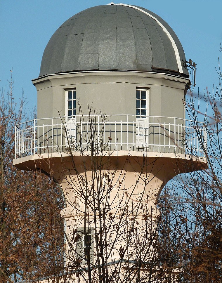
Photo: Brücke-Osteuropa, CC0.
Blasewitz is a larger borough of Dresden, Germany in the city's eastern centre on the Elbe river. It consists of seven quarters : Blasewitz is connected to the borough of Loschwitz north of the river Elbe by the Blue Wonder bridge, Johannstadt to the west, Striesen to the south, and Tolkewitz to the east.
Loschwitz
Suburb

Photo: Masur, CC BY-SA 3.0.
Loschwitz is a borough of Dresden, Germany, incorporated in 1921. It consists of ten quarters : Loschwitz is a villa quarter located at the slopes north of the Elbe river.
Äußere Neustadt
Suburb
Photo: X-Weinzar, CC BY-SA 2.5.
Äußere Neustadt, also known as Antonstadt after Anthony, King of Saxony, is a neighborhood in Dresden, Germany. The Äußere Neustadt contains the part of the Neustadt that is located outside of where the old city walls used to be.
Hochbehälter Fischhaus
- Type: Reservoir
- Category: body of water
- Location: Dresden, Saxon Elbland, Saxony, Germany, Central Europe, Europe
- View on OpenStreetMap
Latitude
51.0732° or 51° 4′ 23″ northLongitude
13.7912° or 13° 47′ 29″ eastOpen location code
9F3M3QFR+7FOpenStreetMap ID
way 588186005OpenStreetMap feature
man_made=reservoir_covered
This page is based on OpenStreetMap, Wikidata, and Wikimedia Commons.
We’d love your help improving our open data sources. Thank you for contributing.
Satellite Map
Discover Hochbehälter Fischhaus from above in high-definition satellite imagery.
Localities in the Area
Explore places such as Waldschlösschen quarter and Radeberger Vorstadt.
Notable Places Nearby
Highlights include Hochbehälter Fischhaus and KKT Dojo.
Saxon Elbland: Must-Visit Destinations
Delve into Meißen, Riesa, Radebeul, and Freital.
Curious Reservoirs to Discover
Uncover intriguing reservoirs from every corner of the globe.
About Mapcarta. Data © OpenStreetMap contributors and available under the Open Database License". Text is available under the CC BY-SA 4.0 license, except for photos, directions, and the map. Photo: Kreidefossil, CC BY-SA 3.0.