Bois de Saint-Denis
Bois de Saint-Denis is a deciduous forest in Saône-et-Loire, Bourgogne-Franche-Comté. Bois de Saint-Denis is situated nearby to the hamlet Le Cerveau, as well as near the locality Ménincourt.| Tap on a place to explore it |
Places of Interest
Highlights include Alignement du Camp de la Justice and Église Saint-Pierre-l’Estrier d’Autun.
Alignement du Camp de la Justice
Archaeological site

Photo: Chabe01, CC BY-SA 4.0.
Alignement du Camp de la Justice is an archaeological site.
Église Saint-Pierre-l’Estrier d’Autun
Church

Photo: Chabe01, CC BY-SA 4.0.
Église Saint-Pierre-l’Estrier d’Autun is a church.
Château de Dracy-Saint-Loup
Castle

Photo: PHILDIC, Public domain.
Château de Dracy-Saint-Loup is a castle.
Places in the Area
Nearby places include Autun and Curgy.
Autun

Photo: Annekoelewijn, CC BY-SA 2.5.
Autun is a subprefecture of the Saône-et-Loire department in the Bourgogne-Franche-Comté region of central-eastern France. It was founded during the Principate era of the early Roman Empire by Emperor Augustus as Augustodunum to give a Roman capital to the Gallic people Aedui, who had Bibracte as their political centre.
Curgy
Village
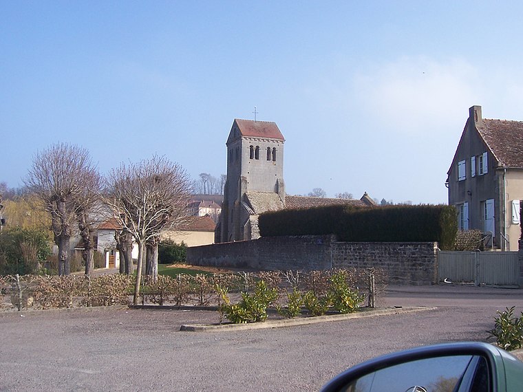
Photo: Ksnow, CC BY-SA 4.0.
Curgy is a commune in the Saône-et-Loire department in the region of Bourgogne-Franche-Comté in eastern France.
Cordesse
Village

Photo: Ksnow, CC BY-SA 4.0.
Cordesse is a commune in the Saône-et-Loire department in the region of Bourgogne-Franche-Comté in eastern France. It is located north of Autun.
Bois de Saint-Denis
- Type: Deciduous forest
- Category: forest
- Location: Saône-et-Loire, Bourgogne-Franche-Comté, France, Europe
- View on OpenStreetMap
Latitude
46.9831° or 46° 58′ 59″ northLongitude
4.3392° or 4° 20′ 21″ eastOpen location code
8FR6X8MQ+6MOpenStreetMap ID
way 594581609OpenStreetMap feature
landuse=forest
This page is based on OpenStreetMap, Wikidata, and Wikimedia Commons.
We’d love your help improving our open data sources. Thank you for contributing.
Satellite Map
Discover Bois de Saint-Denis from above in high-definition satellite imagery.
Localities in the Area
Explore places such as Le Cerveau and Saint-Denis.
Notable Places Nearby
Highlights include Étang Neuf and Grand Bois de Curgy.
Saône-et-Loire: Must-Visit Destinations
Delve into Mâcon, Autun, Paray-le-Monial, and Taizé Community.
Curious Deciduous Forests to Discover
Uncover intriguing deciduous forests from every corner of the globe.
About Mapcarta. Data © OpenStreetMap contributors and available under the Open Database License". Text is available under the CC BY-SA 4.0 license, except for photos, directions, and the map. Photo: Inisheer, CC BY-SA 3.0.