Stroh Ranch
Stroh Ranch is a residential area in Douglas, Colorado. Stroh Ranch is situated nearby to Creekside Park, as well as near the health club Orangetheory Fitness.| Tap on a place to explore it |
Places of Interest Nearby
Highlights include Legend High School.
Legend High School
School
Legend High School is a public high school in Parker, Colorado. It is part of the Douglas County School District RE-1. Legend High School is situated 2 miles east of Stroh Ranch.
Places in the Area
Nearby places include Parker and The Pinery.
Parker
Town
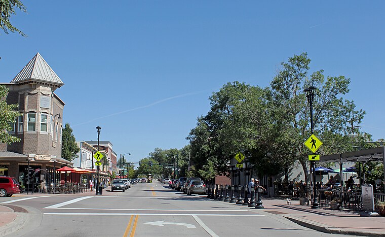
Photo: Denverjeffrey, CC BY 3.0.
Parker is a home rule municipality in Douglas County, Colorado, United States. As a self-declared "town" under the home rule statutes, Parker is the second most populous town in the county; Castle Rock is the most populous. Parker is situated 2 miles north of Stroh Ranch.
The Pinery
Locality

Photo: Denverjeffrey, CC BY 4.0.
The Pinery is an unincorporated community and a census-designated place located in and governed by Douglas County, Colorado, United States. The CDP is a part of the Denver–Aurora–Lakewood, CO Metropolitan Statistical Area. The Pinery is situated 3 miles south of Stroh Ranch.
Stonegate
Locality
Stonegate is an unincorporated community and a census-designated place located in and governed by Douglas County, Colorado, United States. The CDP is a part of the Denver–Aurora–Lakewood, CO Metropolitan Statistical Area. Stonegate is situated 4 miles northwest of Stroh Ranch.
Stroh Ranch
- Type: Residential area
- Location: Douglas, Colorado, Rocky Mountains, United States, North America
- View on OpenStreetMap
Latitude
39.49116° or 39° 29′ 28″ northLongitude
-104.76621° or 104° 45′ 58″ westOpen location code
85FQF6RM+FGOpenStreetMap ID
way 595494419OpenStreetMap feature
landuse=residential
This page is based on OpenStreetMap, Wikidata, and Wikimedia Commons.
We’d love your help improving our open data sources. Thank you for contributing.
Satellite Map
Discover Stroh Ranch from above in high-definition satellite imagery.
Places with the Same Name
Discover other places named “Stroh Ranch”.
Notable Places Nearby
Highlights include Creekside Park and Orangetheory Fitness.
Nearby Places
Explore places such as Stroh Ranch and Cobblestone Car Wash.
Colorado: Must-Visit Destinations
Delve into Denver, Colorado Springs, Boulder, and Aurora.
Curious Residential Areas to Discover
Uncover intriguing residential areas from every corner of the globe.
About Mapcarta. Data © OpenStreetMap contributors and available under the Open Database License". Text is available under the CC BY-SA 4.0 license, except for photos, directions, and the map. Photo: mark gallagher, CC BY 2.0.