Chapelle des Saints Archanges et de Sainte Anne
Chapelle des Saints Archanges et de Sainte Anne is a church in Aix-en-Provence, Bouches-du-Rhône, Provence-Alpes-Côte d’Azur which is located on Rue de Bédarrides. Chapelle des Saints Archanges et de Sainte Anne is situated nearby to the church Église du Saint-Esprit, as well as near Place Séraphin Gilly.| Tap on a place to explore it |
- Type: Church
- Denomination: Greek Orthodox
- Also known as: “Ancienne chapelle des Bourras”
- Address: 13 Rue de Bédarrides, Aix-en-Provence, 13100
Places of Interest Nearby
Highlights include Église du Saint-Esprit and Hôtel d’Arbaud-Jouques.
Église du Saint-Esprit
Church
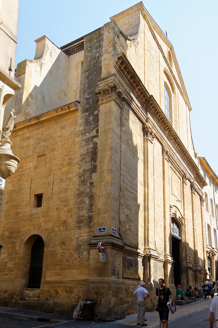
Photo: Bjs, CC BY-SA 4.0.
The Église du Saint-Esprit is a Roman Catholic church in Aix-en-Provence.
Hôtel d’Arbaud-Jouques
Manor estate

Photo: Le Passant, CC BY-SA 3.0.
The Hôtel d'Arbaud-Jouques is a listed hôtel particulier in Aix-en-Provence.
Hôtel, 55 rue Émeric-David (Aix-en-Provence)
Manor estate
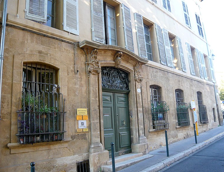
Photo: Le Passant, CC BY-SA 3.0.
Hôtel, 55 rue Émeric-David (Aix-en-Provence) is a manor estate.
Places in the Area
Nearby places include Jas de Bouffan and Célony.
Jas de Bouffan
Suburb

Photo: Bjs, CC BY-SA 4.0.
Jas de Bouffan is a suburb, which is situated 2½ km west of Chapelle des Saints Archanges et de Sainte Anne.
Célony
Neighborhood

Photo: Okki, CC BY-SA 4.0.
Célony is a village close to Aix-en-Provence in France. Célony is situated 4 km northwest of Chapelle des Saints Archanges et de Sainte Anne.
Luynes
Suburb

Photo: Malost, CC BY-SA 3.0.
Luynes is a village of the Bouches-du-Rhône département in southern France. It is located 4 km south of Aix-en-Provence at the intersection of the D7 and N8 roads. Luynes is situated 5 km southwest of Chapelle des Saints Archanges et de Sainte Anne.
Chapelle des Saints Archanges et de Sainte Anne
- Categories: building, chapel, historic site, place of worship, and religion
- Location: Aix-en-Provence, Arrondissement of Aix-en-Provence, Bouches-du-Rhône, Provence-Alpes-Côte d’Azur, France, Europe
- View on OpenStreetMap
Latitude
43.52775° or 43° 31′ 40″ northLongitude
5.44709° or 5° 26′ 50″ eastOpen location code
8FM7GCHW+3ROpenStreetMap ID
way 59685114OpenStreetMap feature
amenity=place_of_worshipOpenStreetMap feature
building=yesOpenStreetMap feature
historic=chapelOpenStreetMap attribute
denomination=greek_orthodox
This page is based on OpenStreetMap, Wikidata, and Wikimedia Commons.
We’d love your help improving our open data sources. Thank you for contributing.
Satellite Map
Discover Chapelle des Saints Archanges et de Sainte Anne from above in high-definition satellite imagery.
Notable Places Nearby
Highlights include Fontaine Gilly and Place Ramus.
Nearby Places
Explore places such as Khroma and La Fée Maraboutée.
Bouches-du-Rhône: Must-Visit Destinations
Delve into Marseille, Arles, Salon-de-Provence, and La Ciotat.
Curious Churches to Discover
Uncover intriguing churches from every corner of the globe.
About Mapcarta. Data © OpenStreetMap contributors and available under the Open Database License". Text is available under the CC BY-SA 4.0 license, except for photos, directions, and the map. Photo: Okki, CC BY-SA 3.0.