BP
BP is a gas station in City of Chester, Delaware County, Pennsylvania which is located on Kerlin Street. BP is situated nearby to the stream Chester Creek, as well as near the mosque Masjid As-Sabiqun.| Tap on a place to explore it |
Places of Interest Nearby
Highlights include Chester Transit Center and St. Michael’s Church.
Chester Transit Center
Railway station
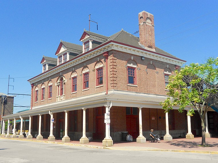
Photo: Smallbones, CC0.
The Chester Transit Center is a SEPTA bus and train station in Chester, Pennsylvania. The outside portion of the ground level serves SEPTA City Transit Division Route 37, and Suburban Transit Division Routes 109, 113, 114, 117, 118, and 119. Chester Transit Center is situated 3,800 feet east of BP.
St. Michael’s Church
Church

Photo: Dwkaminski, CC BY-SA 4.0.
St. Michael’s Church is situated 3,700 feet east of BP.
State Correctional Institution – Chester
Prison
State Correctional Institution – Chester is a medium-security, all-male correctional facility in Chester, Pennsylvania, United States, within the Philadelphia metropolitan area. State Correctional Institution – Chester is situated 1¼ miles east of BP.
Places in the Area
Nearby places include Upland and Parkside.
Upland
Village
Photo: Smallbones, CC0.
Upland is a borough in Delaware County, Pennsylvania, United States. Upland is governed by an elected seven-member borough council. The population was 3,239 at the 2010 census, up from 2,974 at the 2000 census.
Parkside
Village

Photo: Smallbones, CC0.
Parkside is a borough in Delaware County, Pennsylvania, United States. The population was 2,328 at the 2010 census.
Chester

Photo: Smallbones, CC0.
Chester is a city in the U.S. state of Pennsylvania. Chester is a suburb of the city of Philadelphia. The current population estimate is 30,409. The city is predominantly made up of African Americans, making up 79% of the population.
BP
- Type: Gas station
- Address: 1201 Kerlin Street, Chester, PA 19013
- Category: transportation
- Location: City of Chester, Delaware County, Philadelphia Region, Pennsylvania, Mid-Atlantic, United States, North America
- View on OpenStreetMap
Latitude
39.85155° or 39° 51′ 6″ northLongitude
-75.37334° or 75° 22′ 24″ westBrand
BPOpen location code
87F6VJ2G+JMOpenStreetMap ID
way 598557980OpenStreetMap feature
amenity=fuel
This page is based on OpenStreetMap, Wikidata, and Wikimedia Commons.
We’d love your help improving our open data sources. Thank you for contributing.
Satellite Map
Discover BP from above in high-definition satellite imagery.
Notable Places Nearby
Highlights include Chester Creek and Masjid As-Sabiqun.
Nearby Places
Explore places such as Earl L. Foster Funeral Home and New York Fried Chicken.
Delaware County: Must-Visit Destinations
Delve into Chester, Media, Bryn Mawr, and Lansdowne.
Curious Gas Stations to Discover
Uncover intriguing gas stations from every corner of the globe.
About Mapcarta. Data © OpenStreetMap contributors and available under the Open Database License". Text is available under the CC BY-SA 4.0 license, except for photos, directions, and the map. Photo: Wikimedia, CC0.