Die Tafel e.V.
Die Tafel e.V. is a social service facility in Düren, Cologne District, North Rhine-Westphalia which is located on Bücklersstraße. Die Tafel e.V. is situated nearby to the church Apostolische Gemeinde Düren, as well as near the school Gymnasium am Wirteltor.| Tap on a place to explore it |
Places of Interest Nearby
Highlights include Düren station and Stadtmuseum Düren.
Düren station
Railway station
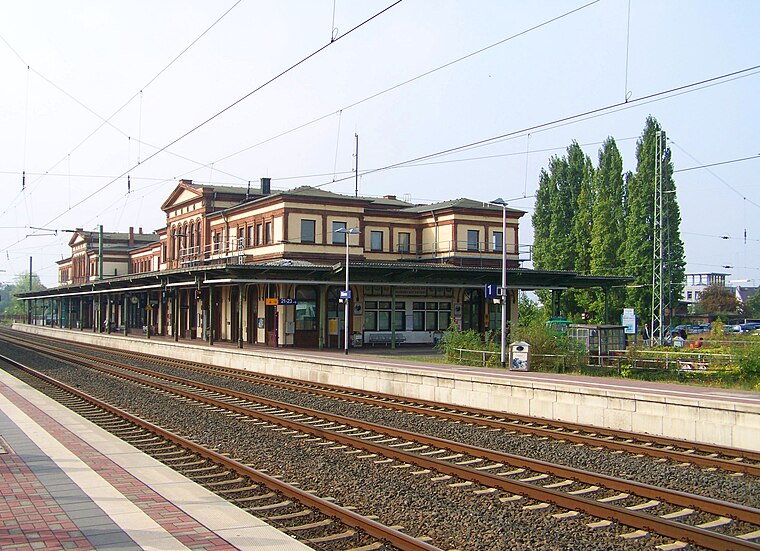
Photo: Zauberfee88, Public domain.
Düren station is located to the north of the centre of Düren and is the largest station in the city and the district of Düren. It is located at the intersection of the Cologne–Aachen high-speed line with the lines to Linnich, Heimbach and Euskirchen. Düren station is situated 220 metres north of Die Tafel e.V..
Stadtmuseum Düren
Museum

Photo: Braegel, CC BY-SA 3.0.
Stadtmuseum Düren is situated 200 metres northeast of Die Tafel e.V..
StadtCenter Düren
Shopping center

Photo: A.Savin, CC BY-SA 3.0.
StadtCenter Düren is a shopping center, which is situated 340 metres southwest of Die Tafel e.V..
Places in the Area
Nearby places include Düren and Grüngürtel.
Düren
Town

Photo: Wikimedia, CC BY-SA 4.0.
Düren is a town in North Rhine-Westphalia, Germany, between Aachen and Cologne, on the river Rur.

Gürzenich
Village

Photo: NDG, CC BY-SA 4.0.
Gürzenich is a village, which is situated 3 km southwest of Die Tafel e.V..
Die Tafel e.V.
- Type: Social service facility
- Address: Bücklersstraße 6, Düren, 52351
- Category: building
- Location: Düren, Cologne District, North Rhine-Westphalia, Germany, Central Europe, Europe
- View on OpenStreetMap
Latitude
50.80808° or 50° 48′ 29″ northLongitude
6.48363° or 6° 29′ 1″ eastOpen location code
9F28RF5M+6FOpenStreetMap ID
way 60097509OpenStreetMap feature
amenity=social_facilityOpenStreetMap feature
building=yes
This page is based on OpenStreetMap, Wikidata, and Wikimedia Commons.
We’d love your help improving our open data sources. Thank you for contributing.
Satellite Map
Discover Die Tafel e.V. from above in high-definition satellite imagery.
Notable Places Nearby
Highlights include Apostolische Gemeinde Düren and Gymnasium am Wirteltor.
Nearby Places
Explore places such as Zollamt Düren and Lebenshilfe Düren.
North Rhine-Westphalia: Must-Visit Destinations
Delve into Cologne, Düsseldorf, Bonn, and Dortmund.
Curious Social Service Facilities to Discover
Uncover intriguing social service facilities from every corner of the globe.
About Mapcarta. Data © OpenStreetMap contributors and available under the Open Database License". Text is available under the CC BY-SA 4.0 license, except for photos, directions, and the map. Photo: Daniel Schwen, CC BY-SA 2.5.